Between 25–27 November 2025, a devastating wave of floods and landslides swept across large parts of Aceh, North Sumatra, and West Sumatra. On 26 November 2025, Cyclone Senyar — a rare tropical storm forming over the Strait of Malacca — made landfall and triggered extreme rainfall across northern and western Sumatra.
Roads washed out, bridges destroyed, and rivers overflowing made access nearly impossible in many areas. But in the face of overwhelmed infrastructure, residents turned to PetaBencana.id, reporting flooded roads, blocked bridges, and unsafe zones in real time. These community-powered reports have allowed neighbors and responders to prioritize evacuations and relief efforts, showing the critical role of local knowledge in cascading disasters.
Why This Flood Happened — It Wasn’t Just Rain
- A Rare Cyclone Triggered Torrential Rain
Meteorologists have identified Cyclone Senyar — a rare tropical storm forming close to the equator — as the main trigger of this week’s extreme rainfall. Cyclones seldom hit near-equatorial Sumatra because the Earth’s rotation (Coriolis effect) is usually too weak to generate storm spin. But unusually warm ocean waters in the nearby straits, combined with shifting wind and moisture patterns as a result of global climate change, created the rare conditions that allowed Senyar to form.
- Fires Fuel Floods
In July 2025, many of the same districts that flooded this week had been hit by a severe wave of forest and land fires across Sumatra. Data shows a near-tenfold increase in fires in these areas compared to the same period last year.
These fires were not isolated incidents—they were part of a long pattern of land-use change driven by plantation expansion and global commodity supply chains, which continue to push ecosystems past their thresholds.
When land burns, the impact is not only the immediate loss of vegetation. Fire alters the soil itself, baking it into a hydrophobic layer that repels water instead of absorbing it. What would normally soak slowly into the ground now becomes fast-moving runoff. Burned vegetation also collapses into ash and loose debris, which gets washed into rivers during the first major storms. This debris creates blockages that choke waterways, block drains, and redirect flows into homes and streets.
Weeks and months later—long after the smoke has disappeared—the consequences of those fires re-emerge as heightened flood risk. What happened in July directly shaped the disaster unfolding now in November: the same communities that breathed the fires are the ones now drowning in the floods.
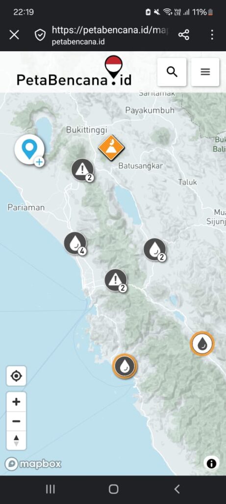
Community Intelligence becomes lifesaving infrastructure
In this unfolding emergency, PetaBencana has played a crucial role. Because formal infrastructure and response capacity have been overwhelmed — many roads are blocked, communication is down, and remote villages are cut off — community‑driven reports become vital.
- Residents on the ground have been using PetaBencana to report flooded roads, blocked bridges, landslides, and unsafe zones in real time.
- These reports help local responders and neighbours to prioritise evacuations, identify dangerous zones, and coordinate relief — especially where official alerts or early warnings were delayed or didn’t reach remote areas.
- In a complex, multi‑hazard disaster like this — where floods, landslides, infrastructure collapse, and extreme weather intersect — community intelligence becomes lifesaving infrastructure.
Leave a Reply