Author: Nashin Mahtani

  • From Street-Level Reports to Rapid Response: How communities are shaping response this monsoon season

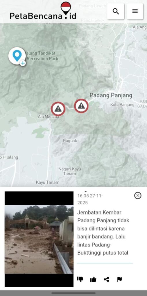
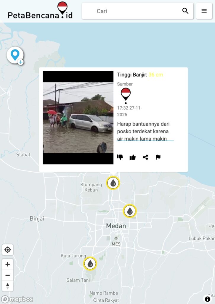
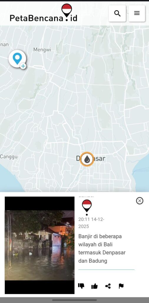
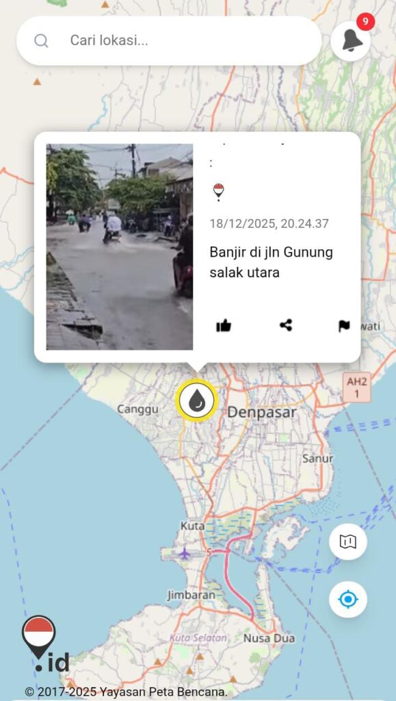
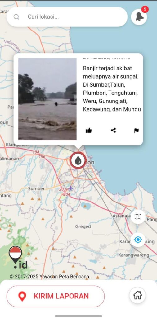
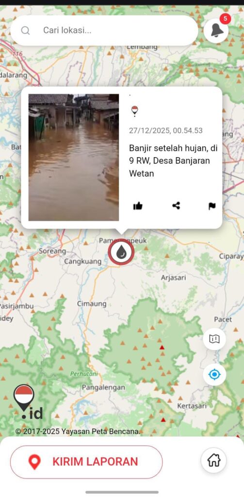
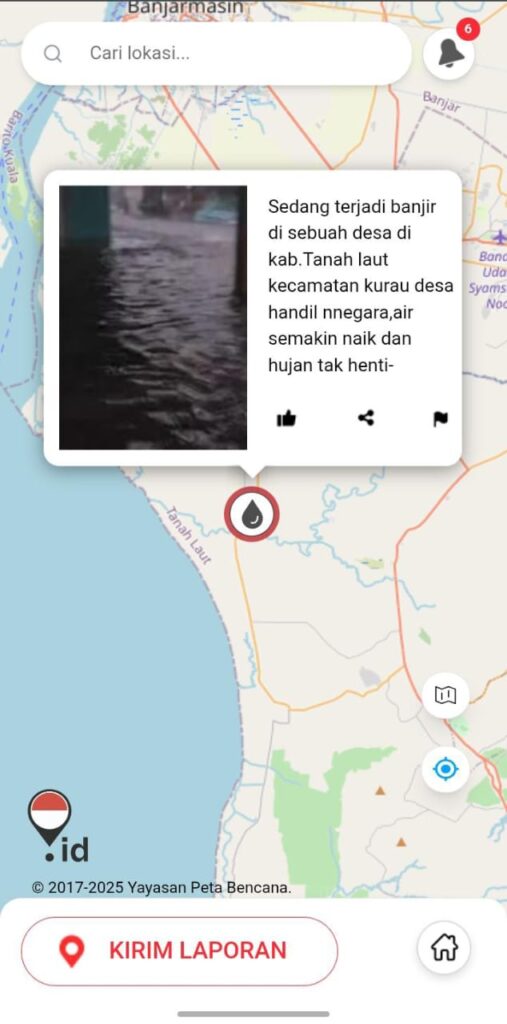
    In the final months of 2025, heavy and persistent rainfall affected large parts of Indonesia. Floods and landslides were reported across Sumatra, Java, Bali, Kalimantan, Bengkulu, and other regions, often emerging quickly and spreading across neighborhoods, roads, and river basins. Local governments declared emergency responses, thousands of families were displaced, critical infrastructure was damaged, and communities across multiple provinces were pushed into crisis.

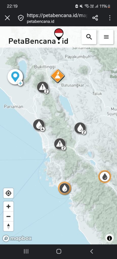
    Amid this wave of impacts, PetaBencana.id has been a critical channel for real-time information sharing, community reporting, coordination, and early warning; helping local partners, government agencies, journalists, volunteers, and residents stay informed and make life-saving decisions.

    In November, Ajang Syarip from Cisurupan, Garut, West Java, reported flooding to PetaBencana.id as conditions worsened with heavy rainfall. “I was surprised how quickly help arrived after I submitted a report to PetaBencana.id. Heavy equipment from the local fire department (DAMKAR), followed by local government emergency management teams (BPBD) handling evacuation and clean up. Food aid was also distributed soon after.” For Ajang, the speed was striking, a reminder that when local observations are communicated clearly and quickly, response can follow while the situation is still manageable. The speed of this response reinforced the value of having a clear, trusted reporting channel that connects communities directly to responders. In moments when minutes matter, structured community reporting helps translate local observations into concrete action.

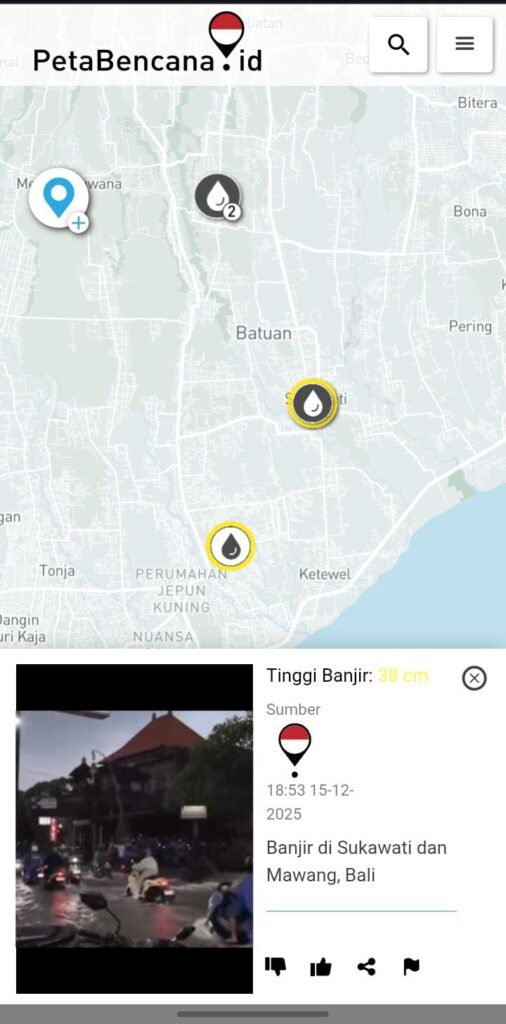
    Oka Agastya, a member of the Bali disaster coordination group, reported flooding as he passed through flooded areas. “First, with PetaBencana.id, I knew exactly where to report. Shortly after I did, the local government emergency management agency (BPBD) arrived quickly to handle the situation. With response arriving much sooner, losses were mitigated. PetaBencana.id also helps me navigate daily life during the rains. The regular updates on flood locations, helps me decide which routes to avoid and how to move more safely. During a season when conditions change rapidly, that shared awareness matters.”

    Ari Bagus Setiawan, a journalist based in Bengkulu, describes relying on PetaBencana to stay updated on disasters across Indonesia while connecting with other reporters and practitioners working on similar issues. As floods and landslides affected multiple provinces at once, the platform helped surface patterns — not just isolated incidents — and supported more informed, contextual reporting at a time when public attention and clarity were crucial. “PetaBencana.id has been a lifeline for me and our community. This isn’t just information, it’s coordination, knowing who else is there and how to respond together. This is so much more than a platform, but a shared space for learning and connection with peers near and far. I hope this space can keep existing and grow, it has completed changed how I experience disasters, and I hope more people can feel the same sense of connection and support when they need it most.”

    For others, the recent floods echoed earlier experiences. Abdul Hafidz Teuku, recalls reporting a flood in Jakarta when PetaBencana first launched years ago. The memory resurfaced during this latest monsoon season as new reports appeared and similar dynamics played out: citizens submitting information, authorities responding, and water levels receding more quickly as a result. “The simplicity and aaccessibility of reporting, has always been key, especially during stressful moments when people need tools that work without friction. After submitting my report to PetaBencana.id, it was quickly acted on by the government. PetaBencana.id really helps us report easily and response come quickly.

    With heavy rainfall expected to continue into the early months of the year, the risk of flooding and landslides remains high in many parts of Indonesia. As conditions continue to shift, staying informed — and sharing information responsibly — remains essential. If you encounter flooding, landslides, or other hazards, report them through PetaBencana.id, follow guidance from local authorities, and prioritize your safety and the safety of those around you. In times of uncertainty, collective awareness and timely reporting can help communities respond faster and reduce risk together.

  • Understanding Sumatra’s Extreme Floods and how communities are responding

    Between 25–27 November 2025, a devastating wave of floods and landslides swept across large parts of Aceh, North Sumatra, and West Sumatra. On 26 November 2025, Cyclone Senyar — a rare tropical storm forming over the Strait of Malacca — made landfall and triggered extreme rainfall across northern and western Sumatra.

    Roads washed out, bridges destroyed, and rivers overflowing made access nearly impossible in many areas. But in the face of overwhelmed infrastructure, residents turned to PetaBencana.id, reporting flooded roads, blocked bridges, and unsafe zones in real time. These community-powered reports have allowed neighbors and responders to prioritize evacuations and relief efforts, showing the critical role of local knowledge in cascading disasters.

    Why This Flood Happened — It Wasn’t Just Rain

    • A Rare Cyclone Triggered Torrential Rain

    Meteorologists have identified Cyclone Senyar — a rare tropical storm forming close to the equator — as the main trigger of this week’s extreme rainfall. Cyclones seldom hit near-equatorial Sumatra because the Earth’s rotation (Coriolis effect) is usually too weak to generate storm spin. But unusually warm ocean waters in the nearby straits, combined with shifting wind and moisture patterns as a result of global climate change, created the rare conditions that allowed Senyar to form.

    • Fires Fuel Floods

    In July 2025, many of the same districts that flooded this week had been hit by a severe wave of forest and land fires across Sumatra. Data shows a near-tenfold increase in fires in these areas compared to the same period last year.

    These fires were not isolated incidents—they were part of a long pattern of land-use change driven by plantation expansion and global commodity supply chains, which continue to push ecosystems past their thresholds.

    When land burns, the impact is not only the immediate loss of vegetation. Fire alters the soil itself, baking it into a hydrophobic layer that repels water instead of absorbing it. What would normally soak slowly into the ground now becomes fast-moving runoff. Burned vegetation also collapses into ash and loose debris, which gets washed into rivers during the first major storms. This debris creates blockages that choke waterways, block drains, and redirect flows into homes and streets.

    Weeks and months later—long after the smoke has disappeared—the consequences of those fires re-emerge as heightened flood risk. What happened in July directly shaped the disaster unfolding now in November: the same communities that breathed the fires are the ones now drowning in the floods.

    Community Intelligence becomes lifesaving infrastructure

    In this unfolding emergency, PetaBencana has played a crucial role. Because formal infrastructure and response capacity have been overwhelmed — many roads are blocked, communication is down, and remote villages are cut off — community‑driven reports become vital.

    • Residents on the ground have been using PetaBencana to report flooded roads, blocked bridges, landslides, and unsafe zones in real time.
    • These reports help local responders and neighbours to prioritise evacuations, identify dangerous zones, and coordinate relief — especially where official alerts or early warnings were delayed or didn’t reach remote areas.
    • In a complex, multi‑hazard disaster like this — where floods, landslides, infrastructure collapse, and extreme weather intersect — community intelligence becomes lifesaving infrastructure.
    Reports on PetaBencana.id shape response during extreme floods in Sumatra, Aceh
  • PetaBencana.id wins first place at the 2025 Safe Steps D-Tech Awards from Prudence Foundation!

    We are proud to share that we have just won First Place at the 2025 SAFE STEPS D-Tech Awards for our real-time disaster mapping software!

    At a time when the Bonn Climate Talks concluded without meaningful progress, and global negotiations stall in the face of compounding crises, this award signals a growing international recognition: solutions aren’t waiting in Geneva or Washington—they’re working in Jakarta.

    “We’ve proven that large-scale, community-led climate action is not only possible, it is already happening,” said Nashin Mahtani, Director of Yayasan Peta Bencana.

    Since launching in 2017, PetaBencana.id (“Disaster Map Indonesia”) has grown into Southeast Asia’s largest people-powered disaster information platform, used by over 200 million people across the region. More than 900 humanitarian organizations now rely on its open data streams to coordinate rapid response.

    A resident navigates real-time flood reports on PetaBencana.id—an open-source platform powered by community input, showing how collective intelligence is reshaping the future of climate response.
    A resident navigates real-time flood reports on PetaBencana.id—an open-source platform powered by community input, showing how collective intelligence is reshaping the future of climate response.

    The platform’s integration into Indonesia’s national disaster management systems demonstrates how local knowledge and formal institutions can work in synergy. Government agencies publicly recognize it as the fastest and most reliable source of real-time information. It is a model of how community insight, when structurally embedded, can strengthen national capacity for climate adaptation.

    This infrastructure is now replicated across the region through the Disaster Map Foundation, which has developed a method for localizing the software. In the Philippines, the platform operates as MapaKalamidad.ph, in use since 2020 and adopted by the national government’s emergency response system. 

    But the real innovation lies in how the technology is governed: through gotong royong, the Indonesian practice of mutual aid and collective responsibility. Citizens, not just authorities, drive decision-making and response coordination—making the platform radically democratic, inclusive, and fast.

    June 2025 has already been one of the hottest months in recorded history, with lethal heatwaves across southern Europe and the southern U.S. At the same time, the UN climate negotiations in Bonn (SB62) stalled on key issues like adaptation finance and loss-and-damage implementation, drawing sharp criticism from frontline nations and civil society.

    Yayasan Peta Bencana’s win is not just an accolade, it is a signal flare: we don’t have to wait for slow-moving global deals to act on climate. Communities have already built models that work—models that the rest of the world, including cities in the U.S. and Europe, can learn from.

    The SAFE STEPS D-Tech Awards—organized by Prudence Foundation in partnership with the International Federation of Red Cross and Red Crescent Societies (IFRC), UNDRR, AWS, and Echelon—recognize innovations that reduce disaster risk and build resilience. Yayasan Peta Bencana took First Place in the Smart Resilience track, emerging from over 100 applications across 31 countries.