Vice President Leni Robredo’s message during the national launch of MapaKalamidad.ph
Disaster Map Foundation (Yayasan Peta Bencana), supported by USAID BHA and endorsed by the Office of Civil Defense (OCD), officially launched MapaKalamidad.ph, a free and open-source real-time flood mapping platform for the Philippines.
In 2021, the Philippines was struck by a total of 22 storms, nine typhoons, and five super typhoons. The most recent, Typhoon Odette, strengthened from a Category 1 to 5 typhoon in just one day making it difficult for people to prepare for the arrival of the storm or to evacuate. As the rapid intensification of storms becomes more common due to climate change, real-time information is increasingly becoming the most important resource to understand and respond to rapidly changing situations.
MapaKalamidad.ph is a free and open-source platform that provides real-time disaster information and transparent communication between residents and government agencies, in order to reduce risk and increase emergency response times during the sudden onset of disasters. The online platform harnesses the use of social media to crowdsource disaster information from residents on the ground, who often have the most up-to-date information, and displays this information on a live web-based map.
The Philippines has some of the highest social media usage rates in the world, and during disasters, social media feeds are inundated with real-time updates by residents calling for help and posting information. However, there is currently no central platform where these posts or reports can be viewed and accessed collectively or spatially. This is the gap that MapaKalamidad.ph fills—by filtering through disaster-related social media posts in real-time, the platform deploys AI-assisted “humanitarian chatbots” to ask social media users to confirm their situation. Verified reports are displayed on a data light, mobile-centric, web-based map that is available to all residents, disaster managers, and emergency responders in order to allow them to view and share real-time flood information and make timely decisions to reduce risk.
The official launch was opened by Madame Vice President Leni Robredo. In her opening remarks, she stated:
“In imagining next-gen bayanihan, MapaKalamidad.ph harnesses not just the power of new tools and technologies, it is built on what is best in the Filipino. I urge everyone, especially youth, not just to share and use share [MapaKalamidad.ph] but to help lead your communities in reducing risk, building resilience, and fostering solidarity to face the ever-growing challenges of our changing climate.”
Madame Vice President Leni Robredo continued to highlight the urgent necessity to invest proactively in disaster preparedness, stating:
“We have long been advocating for stronger disaster preparedness, with risk management plans anchored in our climate change realities, budgeting that prioritizes climate-resilient adaptation programs, and empowering systems that consult and engage affected communities at every step of the process. MapaKalamidad is a significant contribution in this endeavor.”
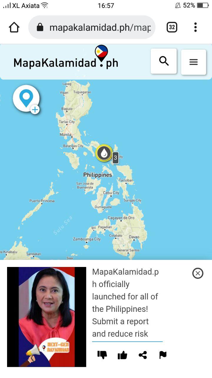
Madame Vice President Leni Robredo’s inaugural report on MapaKalamidad.ph marking the official launch of the national version of the flood mapping platform for the Philippines!
A pilot version of MapaKalamidad.ph was launched in 2020 for Quezon City and Pampanga, in collaboration with the Pacific Disaster Center (PDC) as part of the PhilAWARE project. The platform provides the fastest tool to collect, sort, and visualize real-time disaster updates in order to support response. During Typhoon Ulysess in November 2020, the platform experienced a significant increase in activity as residents in the pilot areas actively shared real-time situational updates about the flood. MapaKalamidad.ph was used to support residents and disaster management units to identify the areas that needed immediate response and rescue efforts. Following the uptake of the platform in the pilot areas, Yayasan Peta Bencana, together with USAID BHA and OCD officially launched the national version of the platform on January 14, 2022.
Nashin Mahtani, Director of Yayasan Peta Bencana, said:
“In building the next generation of bayanihan, it is critical to empower all residents with the tools, agency, and support that will enable communities to self-organize, more equally participate in decision making during emergencies, and adapt to increasingly extreme weather events. By sharing real-time reports about disasters through MapaKalamidad.ph, we can help each other, neighbors, emergency agencies, and first responders better respond to emergency situations.”
According to Joseph Curry, from USAID BHA,
“While we depend on the government to be the authoritative source on damages and needs, we also recognize that those affected have the most up to date information and have an essential role to play. MapaKalamidad.ph adds a new dimension to data and information collection by empowering citizens to directly report hazards, critical lifelines, and damages in their neighborhoods via social media. In the true spirit of bayanihan, MapaKalamidad.ph gives us a tool that everyone can use together in disaster response, potentially connecting every barangay right to the top.”
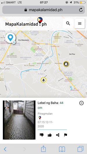
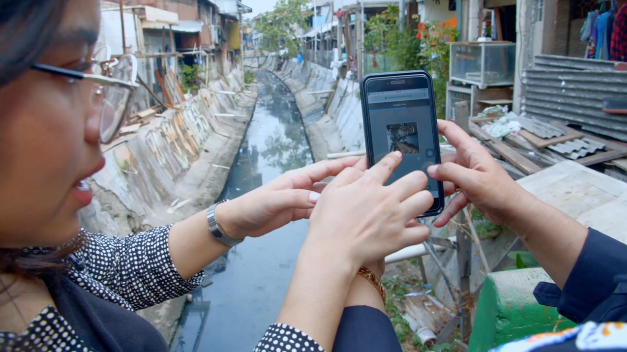
Any resident in the Philippines can submit flood reports anonymously by tweeting #flood or #baha @mapakalamidad, sending a Facebook message to @mapakalamidad, or sending a telegram message to @kalamidadbot, and check https://mapakalamidad.ph for real-time flood updates to navigate safely.
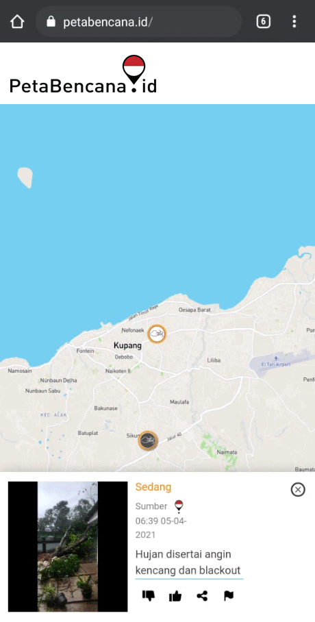
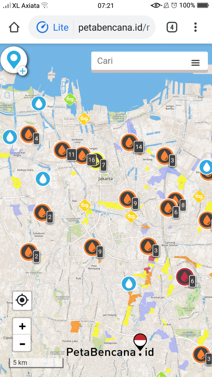
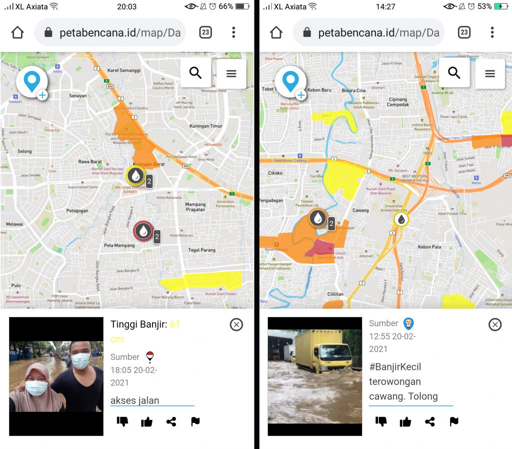 Residents share updates about flood-affected road access through the open source information sharing platform, PetaBencana.id. Thousands of residents used the map to navigate safely as heavy rainfall inundated the city for the third major time this year.
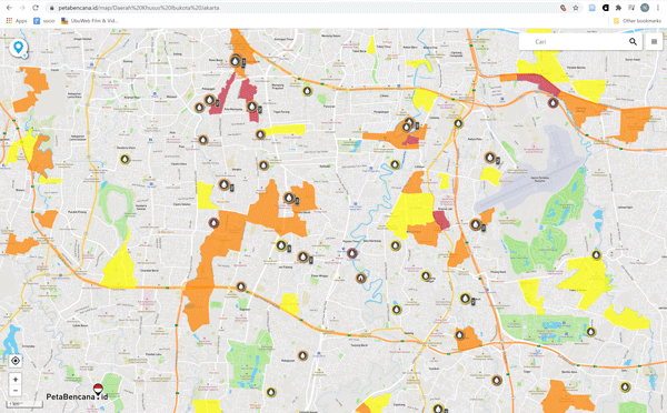
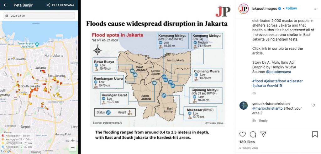 Government agencies and media platforms use crowd-sourced information from PetaBencana.id to share disaster updates. Left: screenshot of Pantau Banjir application; Right: screenshot of Jakarta Post graphic produced with data from PetaBencana.id