The Culminating Event of Disaster Risk Reduction Month in Balikpapan was successfully carried out, and Peta Bencana contributed by presenting its platform on the Ignite Stage and taking selfies with BPBD colleagues from all over Indonesia at our booth. This Culminating Event was organized by BNPB in collaboration with the East Kalimantan Provincial BPBD as part of the 2022 National DRR Month Commemoration Peak Series from October 12 – 14, 2022, carrying the theme “Together We Are Resilient” and the tagline: Bebaya Etam Tegoh.
The opening of the 2022 Disaster Risk Reduction Month Commemoration took place on October 12, 2022, at the BSCC Dome, Balikpapan City. The event was inaugurated by the Deputy for Prevention, Prasinta Dewi, followed by the opening of a disaster exhibition featuring 30 booths. These booths represented Provincial Government, Ministerial Agencies (BMKG, Basarnas, BPBD), NGOs/DRR Communities, Business Institutions, SMEs, and Universities.
Peta Bencana’s participation in the 2022 Disaster Risk Reduction Month Commemoration served as a means to strengthen the understanding of colleagues in government, especially BPBDs, business institutions, and the public, regarding efforts to #BersamaKurangiRisiko as a moment to enhance resilience. One such means was the Resilience Stage, facilitated by Rumah Resiliensi. On this occasion, Peta Bencana also introduced the Partnership Emblem to fellow volunteers and BPBD colleagues to foster pentahelix collaboration and increase community participation, while emphasizing the importance of crowdsourced real-time information for saving lives during disasters.
Hundreds of visitors to the Peta Bencana booth enjoyed taking photos, learning how to submit disaster reports through simulations, and networking and discussing potential training, collaborations, and system integrations utilizing the Peta Bencana platform.
As leaders convene at the G20 and UNCOP27 meetings to deliberate commitments to climate action, residents across the world are already experiencing the impacts of extreme weather and are struggling to adapt to unprecedented scales of weather-related disaster events. As Indonesia braces for peak monsoon flooding, a recently launched nation-wide digital media campaign is supporting residents to stay safe and adapt to extreme weather, from the ground-up. The #ThereIsHelp notification service was launched by Twitter, together with partners Yayasan Peta Bencana and BNPB. Now, when residents search for disaster related keywords in Indonesia, the social media site will include a notification encouraging them to click through to credible information and support provided by Twitter’s official partners, PetaBencana.id and BNPB.
Among Indonesians, the PetaBencana Twitter bot, or “BencanaBot” has become famous for its automatic responses to any post containing disaster-related keywords. The bot asks users to confirm their situation by submitting a disaster report. These reports are mapped in real-time on a free and open source platform, PetaBencana.id, where anyone is able to view and share real-time disaster updates in order to make decisions about safety and response. Since 2013, the platform has been used by millions of residents and first responders in Indonesia to make time-critical decisions about safety and navigation during emergency disaster events. Run by Yayasan Peta Bencana and supported by USAID Bureau of Humanitarian Assistance, the platform is also monitored by BNPB who use the platform to view and respond to incoming resident reports. The launch of the #ThereIsHelp feature supports the amplification of this community-based risk reduction effort, as it ensures that all Indonesians will be directed towards verified and timely information during disasters, thereby supporting greater and more effective coordination for all.
According to BNPB Public Relations Officer Theophilus Yanuarto, who participated in a public conversation on Twitter about the #ThereIsHelp feature, discussions about disaster risk are growing in popularity in Indonesia due to the region’s susceptibility to a wide range of hazards. According to Yunuarto, tools such as PetaBencana provide critical information for the public to support community-level response and increased disaster awareness. In addition, he expressed that increased public participation in disaster information sharing is critical in reducing risk for the nation as a whole, and Yunuarto specifically pointed towards how the crowdsourced data provided on PetaBencana.id helps emergency managers at BNPB effectively respond to disasters.
According to Monrawee Ampolpittayanant, Head of Public Policy and Philanthropy for Southeast Asia at Twitter, “Our core objective of launching this #ThereIsHelp notification search prompt is to truly help shorten the search time and to provide timely access to credible information from our partners to those in need. In collaboration with BNPB Indonesia (@BNPB_Indonesia), Peta Bencana (@PetaBencana), MERCY Malaysia (@MERCYMalaysia), and NADMA Malaysia (@mynadma), we hope this notification service can serve as a means to help the Indonesian and Malaysian public, as well as government and non-government stakeholders navigate the extreme weather that the monsoon season brings in along with other unprecedented disaster events.”
According to Nashin Mahtani, Director of Yayasan Peta Bencana, “As extreme weather events become more frequent and severe, it is imperative that every single person is empowered to participate in disaster risk reduction and recovery efforts. During disasters, the first source people turn to is often social media. In a time of information overload, the #ThereIsHelp prompt helps to quickly direct people towards trusted and verified source of information, so that everyone is able to proactively act on their own safety and participate in the civic co-management of disasters. We celebrate the #ThereIsHelp initiative and are grateful to collaborate with our long-time partners at Twitter to ensure that all residents have easier, immediate, access to credible information during emergency situations and are aware of the ways they can participate in our shared goals of reducing risk together through digital gotong royong!”
With a historical triple La Nina this year, Indonesia is expected to receive higher than usual rainfall. We remind residents to stay informed and stay safe! Anyone in Indonesia can submit an anonymous disaster report by tweeting @petabencana, sending a telegram message to @bencanabot, or sending a facebook message to @petabencana.
At the 2022 G20 Summit in Indonesia, Yayasan Peta Bencana director, Nashin Mahtani, met with Canada’s Foreign Minister, Mélanie Joly, to discuss strategies for advancing youth-led climate adaptation efforts across the Indo-Pacific region. Mahtani was selected as an Indonesian youth delegate to advocate for environmental sustainability and climate resilience with global leaders at the G20.
The discussion highlighted the vital role that young leaders play in driving innovative and community-driven responses to global challenges, including the climate crisis. With the Indo-Pacific region facing increasing risks from extreme weather events, the conversation focused on strengthening cross-border collaboration, fostering knowledge exchange, and ensuring that disaster response technologies remain accessible and adaptable to local contexts.
Minister Joly and Nashin discussed opportunities to integrate youth perspectives into climate adaptation policies, emphasizing the importance of digital public infrastructure, open data, and community-driven governance.
In preparation for COP27, PetaBencana was invited to participate at the “Intergenerational Thinkshop for Hydromet Early Warning Early Action (EWEA): The Engagement of Young Professionals in Disaster Risk Reduction” in Cairo. The ‘Thinkshop’ gathered stakeholders from across 5 generations, representing a range of geographic backgrounds from across 4 continents, coming from a range of disciplines including academics, first responders, NGOs, emergency managers, and scientists. Participants gathered to discuss adaptation efforts to increasingly escalating hydrometeorological shocks due to climate change, and to reflect on the implications of the UN Secretary General Guterres initiative to ensure that “every person on Earth is protected by early warning systems within five years”. The workshop was also attended by head of the Egyptian Meteorological Agency, who iterated his commitment to ensure multi-hazard warning systems for all.
PetaBencana was invited to share our experience working with residents across Indonesia to adapt to extreme weather events, where we highlighted the role of local knowledge in risk reduction, and involving local communities as co-designers of risk reduction programs.
As the culmination of the workshop, together with the participants we co-published a Cairo Statement which will be presented to leaders and stakeholders at COP27. The statement highlights the need to consider the full spectrum of warning and action within the early warning system discussion, acknowledging that the social and behavioural aspects of warning systems, or the ways by which people are equipped and empowered to take action, is a significant portion of the warning infrastructure that has seldom been discussed. History has shown that an improved forecast does not always translate to more proactive responses to warnings. Instead of investing on predictive modelling and technical systems only, equal attention must be given to the behavioural aspects of risk reduction – that is, how people respond to warnings. Additionally, warning systems cannot be thought of as a one-way delivery from large institutions. Local, residential, and indigenous knowledge also play an invaluable role in detecting the earliest warning signals, which are often apparent only through situated, place-based perceptual skills and so must be integrated into monitoring systems on an equal basis with more technical tools of detection. The statement also highlights that funding for the early warning system initiative must prioritize the most vulnerable individuals and areas first. The full statement can be read here.
To commemorate the Month for Disaster Risk Reduction (Bulan PRB), BNPB hosted an annual event in Balikpapan on 12-14 October 2022, where PetaBencana was invited to participate as a speaker and exhibitor. We set up our famous 3D mural at the event, and hundreds of emergency managers from provincial and local disaster management agencies (BPBDs) all across Indonesia, stopped by to take selfies and practice simulating reports via PetaBencana.id. was successfully carried out and Peta Bencana contributed to presenting the platform on the Ignite Stage and taking selfies with BPBD colleagues from all over Indonesia at our booth.
The opening of the 2022 Disaster Risk Reduction Month Commemoration was held on October 12, 2022, at the BSCC Dome, Balikpapan City. This event was opened by the Deputy for Prevention, Prasinta Dewi, followed by the opening of a disaster preparedness exhibition where stakeholders representing Representatives of the Provincial Government, Ministry of Institutions (BMKG, BASARNAS, BPBD), NGOs / DRR Communities, Business Institutions, and SMEs and Universities, had the opportunity to showcase their work in DRR.
Yayasan Peta Bencana’s involvement in the events was a great way to strengthen the understanding of colleagues in the government, especially BPBDs, business institutions, and the community regarding our efforts to #ReduceRiskTogether by involving public participation in disaster risk reduction. During the session, we showcased our two-way disaster reporting features, which allow for greater coordination among government agencies and the public.
Thank you to everyone who visited, took selfies, learned how to submit disaster reports! We are excited to continue the collaborations and strengthen the network of people who are able to harness the data from PetaBencana.id in order to make evidence-based, coordinated decisions during disasters, and save lives!
On International Disaster Risk Reduction Day, Yayasan Peta Bencana was featured on the South East Asia Morning Show for our work in community-led risk reduction in the region. During the interview with hosts Marissa Anita and Paul Palele, we discussed the history of PetaBencana.id, the development and expansion of MapaKalamidad.ph in the Philippines, disaster trends in the region, and of course, explained how #SelfiesSaveLives!
We also discussed the next trajectories of our work in community-led climate adaptation. We look forward to continuing to #ReduceRiskTogether and thank the SEA Morning Show for providing the space to share our work in the region. Watch the full interview here!
On September 16th, 2022, we collaborated with our partners at Twitter to launch a 24-hour nation-wide disaster preparedness campaign. In preparation for the upcoming monsoon season, we called on Indonesian residents to practice submitting disaster simulation reports to PetaBencana.id by uploading their best selfies to the map. With the #SelfieDermawan hashtag trending on Twitter, over 25 million Indonesians engaged with the campaign, and the PetaBencana.id map lit up with selfies from all over Indonesia!
Through this campaign, we celebrated the faces of everyone who has been in a disaster, has helped during a disaster, or is willing to help in future disasters. As a testament to the strong spirit of “Digital Gotong-royong”, residents all over Indonesia joined in on the campaign to remind our respective communities about the importance of sharing real-time information for disaster response in preparation for the upcoming monsoon season.
Why selfies? More effective than any sensor, selfies contain valuable information about the relative severity of a flood (or other disaster) in relation to a body and place. Importantly, selfies shared on social media provide precise, real-time information about locally specific conditions, as these images are geo-tagged. According to the IPCC report, one of the greatest barriers to climate adaptation is the lack of locally relevant time-sensitive information. However, with the abundant data being shared on social media we know that this is a barrier that can be resolved. PetaBencana.id is able to collect, structure, and visualize this data in real-time, transforming the selfie into a life-saving tool for everyone to make time-critical decisions about safety and response.
Thank you to all partners and residents for participating in the #SelfieDermawan campaign! Of course, thank you to the residents who inspired us with their original social media flood selfies, demonstrating that even during a disaster, we can graciously help our communities, and that a selfie can in fact save lives.
The 7th Session of the Global Platform for Disaster Risk Reduction (GPDRR) was officially inaugurated by Indonesian President Joko Widodo along with UN Deputy Secretary General Amina Mohammed, President of the 76th Session of the UN General Assembly Abdulla Shahid, UN Resident Coordinator for Indonesia Valerie Julliand, and the special representative of the UN for disaster risk reduction, as well as several Indonesian officials on May 25, 2022. Organized in a hybrid format, the Global Platform had over 6300 participants from a total of 185 countries.
During his opening remarks, President Joko Widodo encouraged the international community to enhance collaborative cooperation in disaster risk management, emphasizing the need for strengthened risk reduction culture and education, investment in science and technology, climate and disaster resilient infrastructure, and the implementation of global commitments.
As the main multi-stakeholder global forum to assess and discuss progress, share knowledge, and identify gaps in the implementation of the Sendai Framework for DRR 2015-2030 (a global, non-binding agreement, adopted in 2015 at the Third UN World Conference on DRR in Sendai, Japan) the GPDRR provides a platform for reflection, evaluation, and commitment to more ambitious efforts for inclusive disaster risk reduction, based on the experience of practitioners and policymakers, as well as recent reports such as the IPCC Sixth Assessment report.
Co-chaired by H.E. Prof. Muhadjir Effendy, Coordinating Minister for Human Development and Cultural Affairs of the Republic of Indonesia, and Ms. Mami Mizutori, Special Representative of the United Nations Secretary-General for Disaster Risk Reduction, the forum acknowledged the insufficiency in investment and progress in disaster risk reduction so far. According to the co-chair summary, “the Sustainable Development Goals are not on track” and “disaster-related economic losses continue to rise.” Findings indicate that less than half of the countries reporting against Sendai Framework targets indicate having accessible and actionable disaster risk information, with effective disaster risk management often hindered by siloed approaches.
As part of the core agenda of the GPDRR, the plenaries of the midterm review of the implementation of the sendai framework for disaster risk reduction, are an important contribution which concludes at a high-level meeting of the UN General Assembly in May 2023. The plenaries invited participants across different sectors to engage in a moderated discussion to offer their interventions, the results of which would contribute to the adoption of a political declaration at the UN General Assembly in 2023, which will inform further implementation of the Sendai Framework.
The first mid-term plenary was co-chaired by Lieutenant General Suharyanto, head of the National Disaster Mitigation Agency (BNPB), who pointed out the lack of integration in disaster risk reduction financial planning.
Yayasan Peta Bencana was part of this first meeting of government, non-government, and UN agencies, and civil organization representatives to evaluate the application of the Sendai Framework. Director of Yayasan Peta Bencana, Nashin Mahtani, delivered an intervention calling for the support of open source technology and tools for climate emergency within a Planetary Health Framework as the evolution of and complement to the Sendai Framework.
Drawing attention to vaccine patenting as a failure to respond to the global covid-19 pandemic, Yayasan Peta Bencana’s statement iterated the need for open source tools in addressing the climate emergency. “Sustainable development must recognize the right for all countries to have equal access to the scientific knowledge and tools that are needed to adapt and mitigate risk. Open source tools foster invaluable lateral exchange, and enable us to address global challenges collectively, making far more effective use of investments and resources. Investments for climate adaptation must be, and remain, open source to enable equitable, democratic participation and increased cooperation on technology development, transfer, and maintenance,” said Mahtani.
Yayasan Peta Bencana’s intervention also called for a more comprehensive repricing of risk, accounting for externalities of commercial activities on biodiversity and wellbeing, calculated for at least the next seven generations. Importantly, the intervention stressed the need to develop the parameters of risk repricing with indigenous and local communities, with risk assessments placing local knowledge at the forefront.
Other interventions were delivered by the Vice Minister of Economy, Planning and Development of the Dominican Republic, Executive Director of National Disaster Management Agency of Liberia, Director General for the National Center for Disaster and Environmental Emergency Mangement of Guinea, Swedish ambassador to Indonesia, Director of the Office of Civil Defense from the Philippines, Director General for Risk and Emergency Management from Ecuador, Director Generaal of Emergency Management Policy and Outreach of Canada, Permanent Representative to the United Nations in New York, Deputy Director General of JICA, Deptury Director of Disaster Prevention Division, Ministry of Labor and Social Welfare from Lao People’s Democratic Republic, Head of Strategic Development of the National Commsion for Risk Preventiaon and EMergency Care from Costa Rica, Executive Secretary of National Coordination for Risk REduction of Disasters from GUatemala, Executive Director of the Territorial Planning and Civil Protection Office at the Province of Potenza from Italy, First Assistant Secretary at the Humanitarian and Partnerships Division at teh Department of Foreign Affairs and Trade from Australia, Head of Department of Risk Assesment and Planning of the GOvernment Centre for Secutrity from Poland, Senior Engineer at the National Agneyc for Research and Innovation from Indonesia, Director of the National Risk Management Commission from Ethiopia, among several others. During the interventions that were delivered by a diverse range of stakeholders, there was a resounding call to increase commitment to socially transformative outcomes including strengthening the meaningful participation of at-risk communities, women and girls, and youth, as well as the need to address and acknowledge barriers and biases in order to frame appropriate enabling policies and programmes.
During the third mid-term plenary, addressing the theme of timely multi-lateral risk governance built upon diverse knowledge systems, Director of Yayasan Peta Bencana, Nashin Mahtani, delivered an intervention calling for commitment to involve all residents as equal agents in the co-management of risks.
The intervention emphasized the need to involve local residents as co-designers of risk management systems. “The scale of challenges we face today demand that we increase the agency of every single resident to participate in their own disaster recovery efforts. We must provide accessible tools for people on-the-ground to share their local situational knowledge, and harness collective intelligence to support complex crisis management,” Mahtani said.
The co-chairs summary of the GPDRR 2022 resounded many of the concerns expressed at the midterm plenary, iterating the need for systemic transformation in governance and financing, holistic integration of disaster risk reduction across all sectors, the critical need to break silos and disaggregated data including through greater interoperability across systems, increased commitment to community-led disaster risk reduction including emphasis on communication and education.
The co-chairs summary stated:
“Recovery and reconstruction are most successful when they are community-driven, and address inequalities through gender responsive and human-rights based approaches. People are affected differently by disasters. This calls for a participatory and human rights based approach to include all under a principle of “nothing about us without us” in disaster risk reduction planning and implementation. There should be a recommitment to community engagement and to disaster risk reduction that is community-driven and supports existing local structures.”
Convened at the midpoint between COP 26 and COP 27, the Global Platform acknowledged that current emission levels far exceed their mitigation, resulting in an increase in frequency and intensity of catastrophic events, threatening the achievement of the 2030 Agenda. The Global Platform called upon governments to honor the commitments made in Glasgow to drastically enhance financing for and support to adaptation. “There is an urgent need to scale-up disaster risk reduction as part of the solution to address the climate emergency, while raising and achieving the climate ambition,” said the co-chairs.
Yayasan Peta Bencana is committed to enabling democratic forms of participatory climate adaptation and risk reduction, including providing the necessary tools, knowledge exchange, and infrastructure to address the climate emergency collaboratively. We are honored to have been one of two local NGOs invited to exhibit our work at the “Innovation Platform” agenda of the GPDRR. These innovations were selected by the UN to provide input for the implementation of the UN Secretary General’s Vision for “Our Common Agenda”. The Innovation Platform showcased the software underpinning PetaBencana.id, and its design and development as a process emerging from multi-stakeholder partnerships including with USAID Bureau of Humanitarian Assistance, BNPB, Office of Civil Defense, NDRRMC, Pacific Disaster Center, Humanitarian Open Street Map Team, Civic Data Lab, Twitter, Mapbox, PasangMata, and all residents reducing risk together. The exhibit at the “Innovation Platform” also featured other instances supported by our open source software in the region including MapaKalamidad.ph (Philippines), SmartSaigon (Vietnam), and BreadLine by HongKong FoodWorks.
During a session titled “No Districts Left Behind: Meeting At-Risk Residents Halfway for Next Generation DRR in Southeast Asia”, Alvin Gus, Communications and Public Relations Coordinator at Yayasan Peta Bencana, and Angelika Fortuna, Project Research Coordinator at Yayasan Peta Bencana, drew from our experience in increasing public participation in disaster risk reduction to share the core principles of digital gotong royong as a trajectory to address core themes presented at the GPDRR.
Yayasan Peta Bencana also had a chance to meet with visiting delegates from our partners at the USAID Bureau of Humanitarian Assistance (BHA), including Ms. Sarah Charles, Assistant to the Administrator of USAID’s BHA; Mr.Jeffrey Cohen, USAID Mission Director Indonesia; Mr. Harlan Hale, Regional Advisor USAID BHA; Jessica Doxtater, Program Officer USAID BHA.
As Indonesia hosts two major global forums this year, including the GPDRR and the G20 Summit in November, Yayasan Peta Bencana harnessed this convening to kick start a “disaster-prepared hospitality” program. As an amplification to the official GPDRR events, we partnered with official hotels including Nusa Dua Beach Hotel & Spa, Ibis Styles Benoa Bali, Amaris Hotel, and Novotel. Employees of partner hotels were trained in disaster risk reduction including on how to view and share real-time disaster information on PetaBencana.id. Hotel partners installed PetaBencana’s 3d disaster-themed murals in their lobbies, joining in the #SelfiesSaveLives campaign to inform visiting delegates on how PetaBencana.id is used during disasters, and as an example of community-led disaster risk reduction. Hotel partners also displayed the film, “The Same River Twice”, produced by Yayasan Peta Bencana to narrate the story of how open source tools are revolutionizing inclusive forms of disaster risk reduction in the region.
Photo with Nusa Dua Bali Hotel staff
Yayasan Peta Bencana was honored to also be joined by Bali-based Disaster Risk Reduction Youth Ambassador, Lestari Wulandari, and her students from SMAN 1 Abang, and to have been able to exchange stories with our top trainers, Topandra and Muhammad Arinda, who traveled from Bangka Belitung to participate in the week’s activities.
We thank all our partners for their support in this shared journey to #ReduceRiskTogether, and remain ready to partner and support efforts for inclusive forms of disaster risk reduction.
Community-led information sharing through PetaBencana.id supports response and relief efforts as severe flooding strikes Medan.
Heavy rainfall from February 27 to February 28th inundated almost the entire city of Medan, with some areas experiencing flood waters up to 2 meters high.
According to first-hand reports submitted to PetaBencana.id, the extreme weather has blocked major thoroughfares as embankments burst under the increasing intensity of rainfall. Residents have been sharing real-time updates through the PetaBencana.id platform to help keep each other informed, and support response efforts.
According to the Indonesian Meteorological, Climatological, and Geophysical Agency (BMKG) extreme rainfall is expected to continue in the coming weeks across several areas in Indonesia, including Sumatra and Java.
We remind residents to check https://petabencana.id for up-to-date information. Residents can also submit real-time flood reports by tweeting #banjir @petabencana, sending a Facebook message to @petabencana.id, or sending a Telegram message to @bencanabot. When we share what we see, everyone can stay informed, avoid danger, and reduce risk together!
Photo submitted to PetaBencana – community organized open kitchens offer safe spaces for flood affected residents.
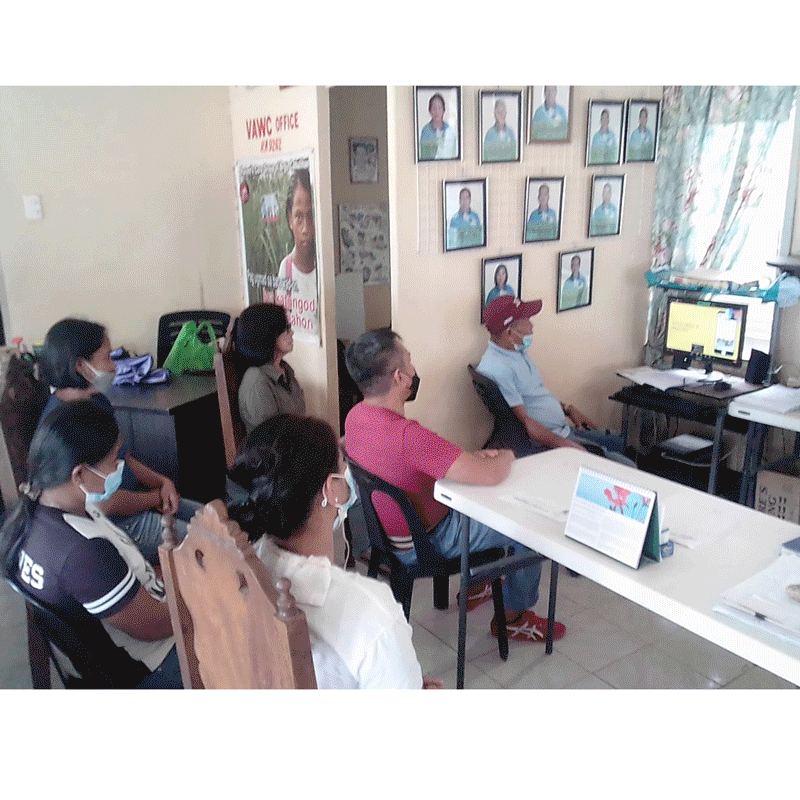
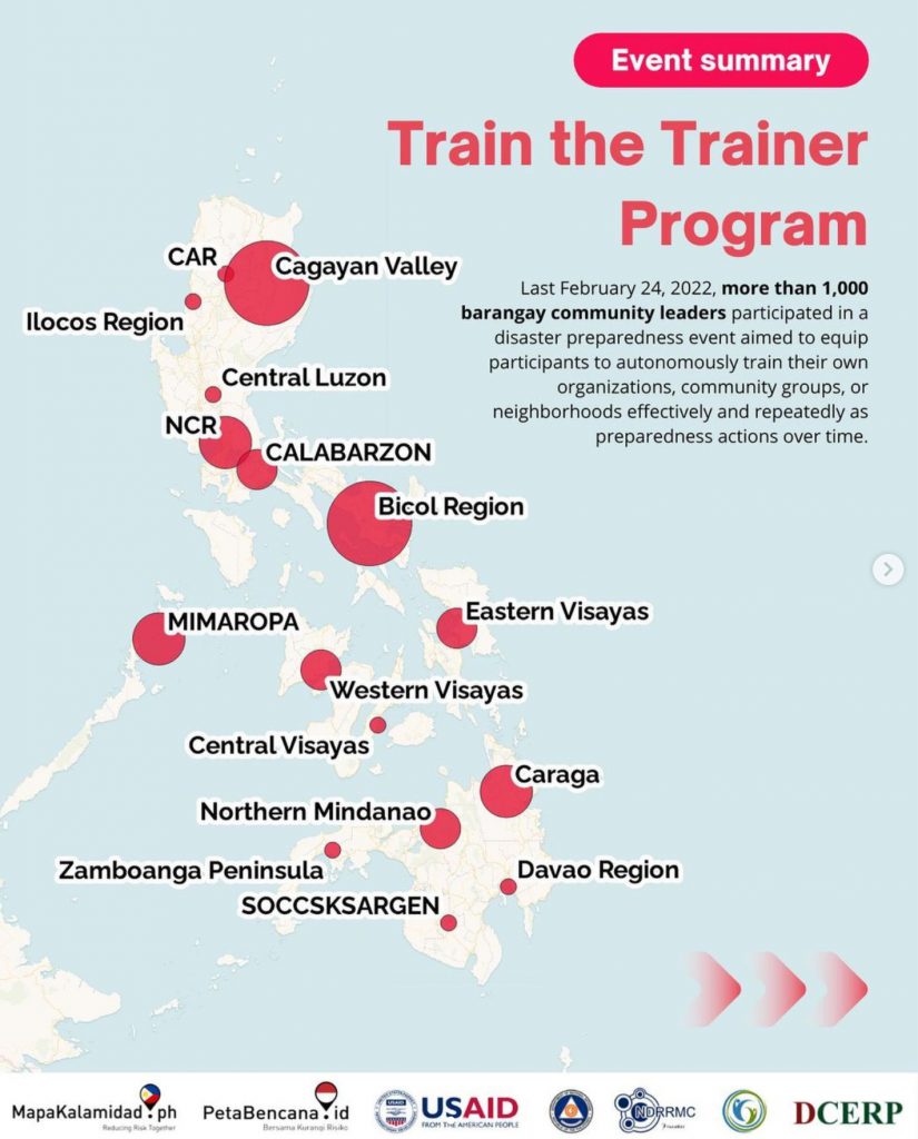
Yayasan Peta Bencana, supported by USAID BHA and endorsed by the Office of Civil Defense (OCD), conducted a nationwide disaster preparedness event with barangay community leaders from all over the Philippines!
Attended by more than a thousandbarangay community leaders, participants simulated real-time disaster information sharing via the MapaKalamidad.ph platform. MapaKalamidad.ph is a free and open-source platform that provides real-time disaster information and transparent communication between residents and government agencies, to reduce risk and increase emergency response times during the sudden onset of disasters. The online platform harnesses the use of social media to crowdsource disaster information from residents on the ground, who often have the most up-to-date information, and displays this information on a live web-based map.
An average of 20 typhoons per year enter the Philippine area of responsibility. In 2021, the country was struck by a total of 22 storms, 9 typhoons, and 5 super typhoons. The most recent one, Typhoon Odette, strengthened from category 1 to 5 in just one day making it difficult, if not impossible, for people to prepare. As the rapid intensification of storms becomes more common due to climate change, real-time information is increasingly becoming the most important resource to understand and respond to rapidly changing situations.
In the Philippines, millions of residents already actively share real-time updates through their social media networks. However, there is currently no central platform wherein these real-time posts or reports are being gathered, sorted, and geospatially related, for easy access and public viewing. This is the gap that MapaKalamidad.ph fills–the platform deploys AI-assisted “humanitarian chatbots” to automatically respond to disaster-related social media posts, and asks users to confirm their situation by submitting a disaster report. Verified reports are displayed on a data light, mobile-centric, web-based map that is available to all residents, disaster managers, and emergency responders to allow them to view and share real-time flood information and make timely decisions to reduce risk.
As a community-led disaster information sharing platform, MapaKalamidad.ph is developed through collaboration and sustained engagement with the widest variety of stakeholders. On Thursday, February 24th, MapaKalamidad.ph’s disaster preparedness event invited barangay leaders to participate in a live demonstration that exemplified how crowdsourced information collected via MapaKalamidad.ph could be leveraged to support response in their areas of responsibility. Barangay leaders participated in a “train the trainer” activity, aimed to equip participants to autonomously train their own organizations, community groups, or neighborhoods effectively and repeatedly as preparedness actions over time.
Disaster reports submitted to MapaKalamidad.ph are also pivotal to help emergency managers better understand and respond to on-the-ground situations. Data collected by MapaKalamidad.ph is automatically integrated into OCD’s PhilAWARE Disaster Monitoring platform. According to Joseph Curry, from USAID BHA, “In the true spirit of bayanihan, MapaKalamidad.ph gives us a tool that everyone can use together in disaster response, potentially connecting every barangay right to the top.”
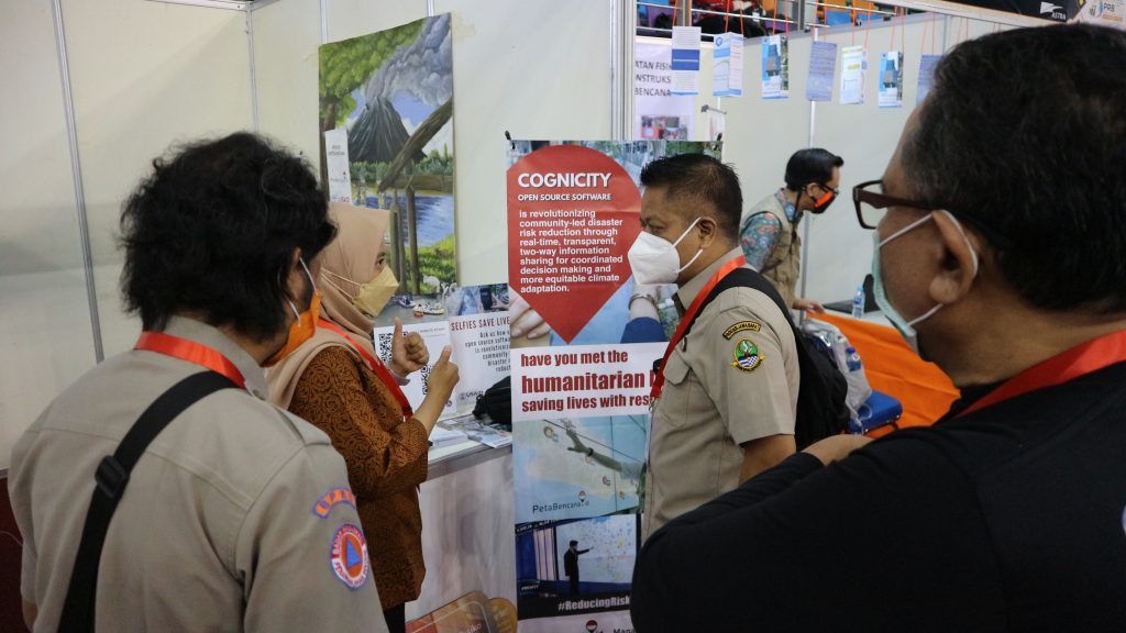

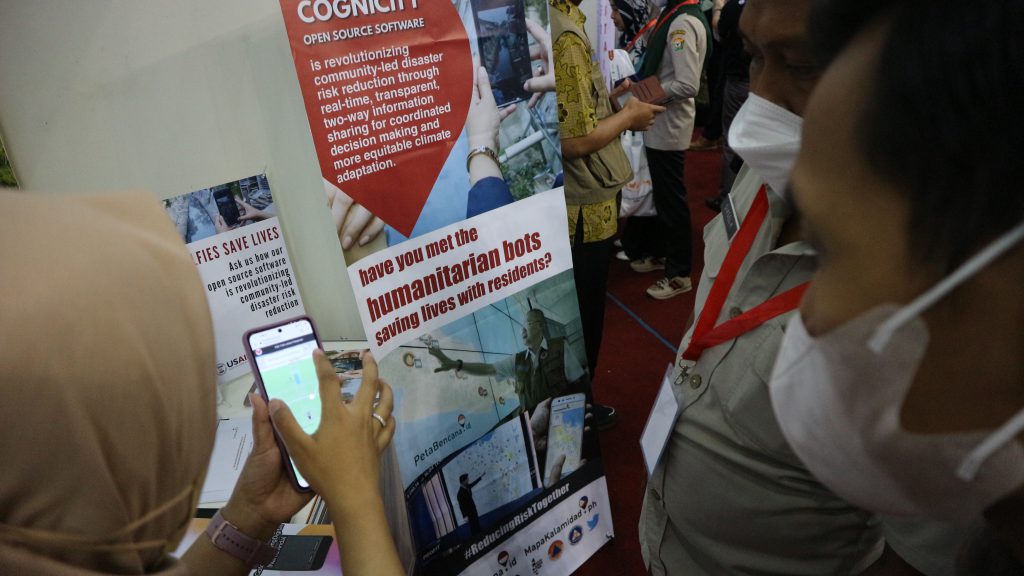

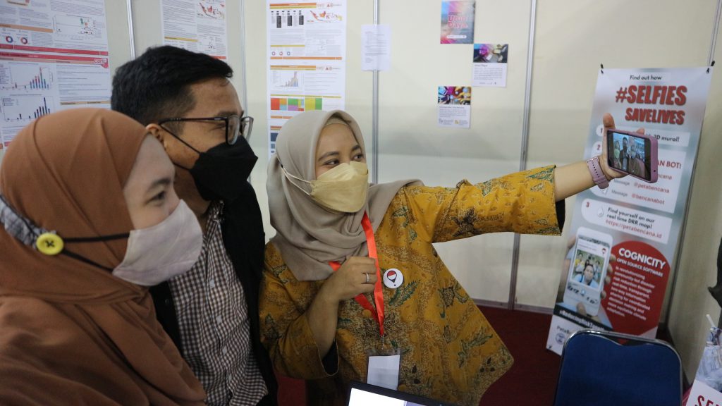
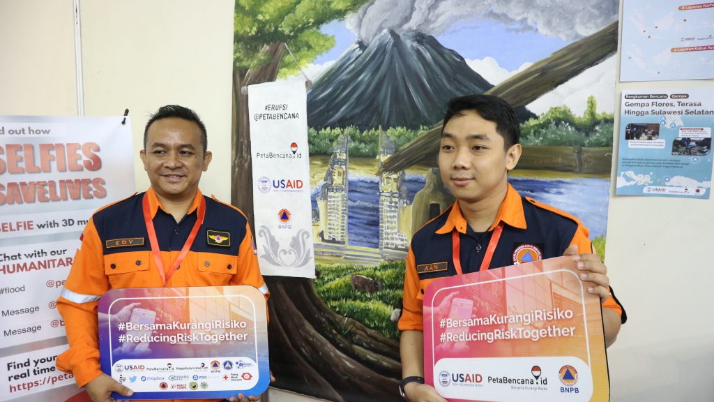
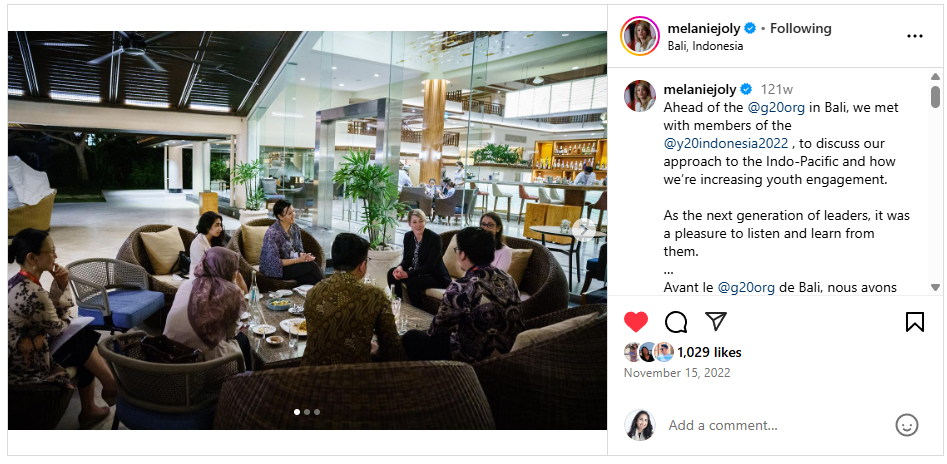
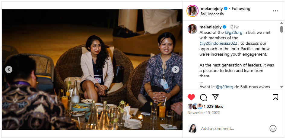
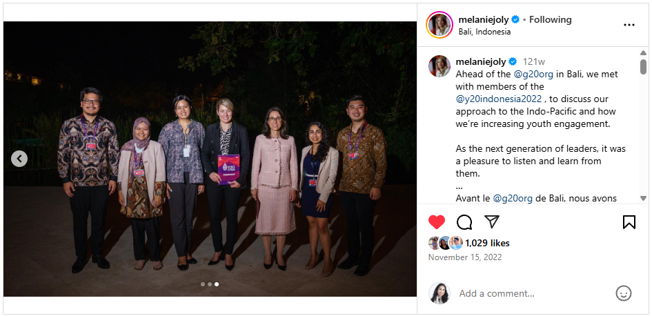

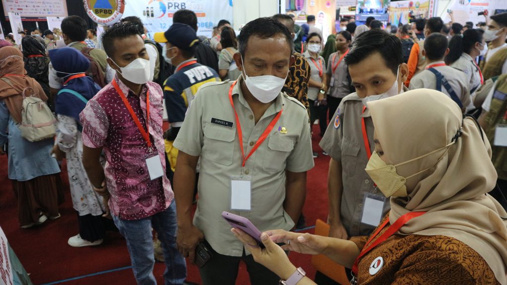

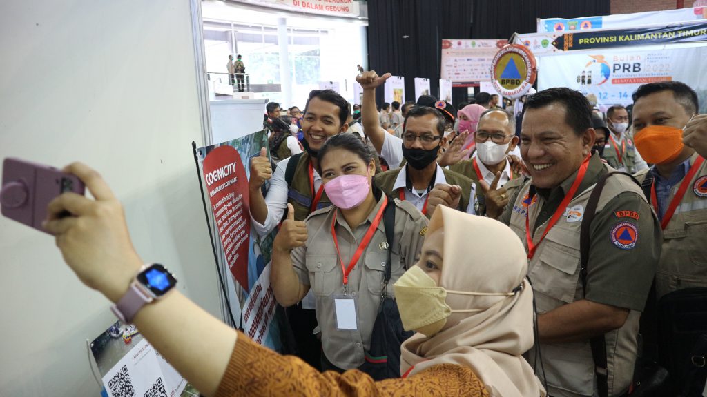


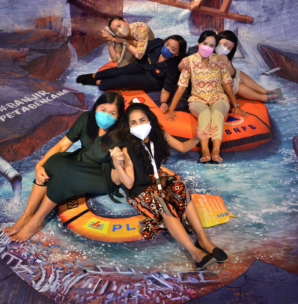 Photo with Nusa Dua Bali Hotel staff
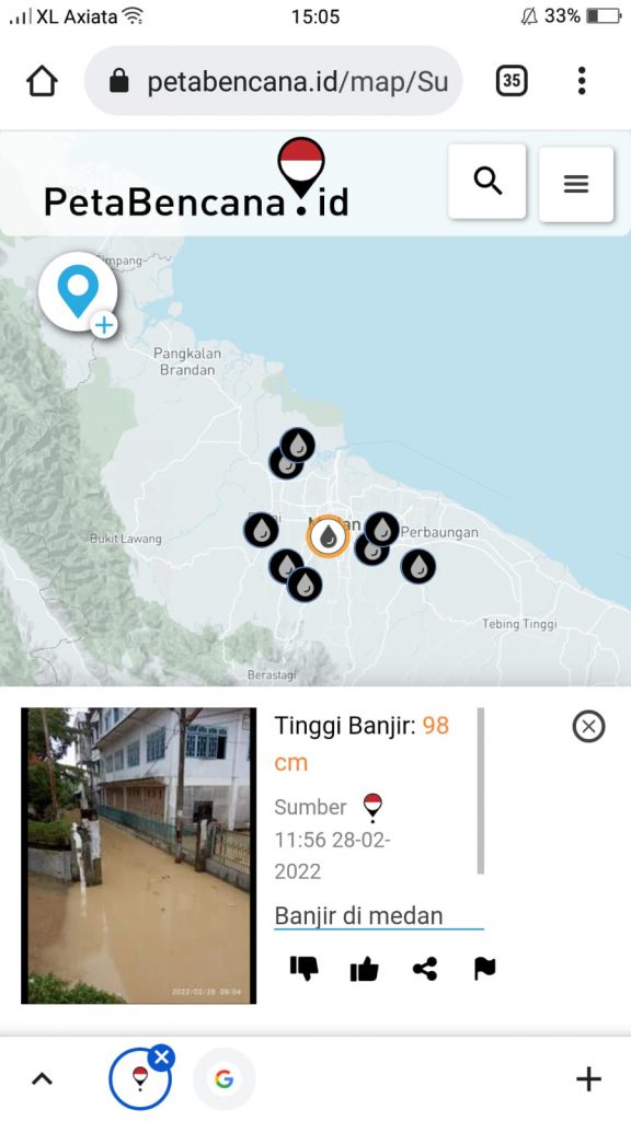
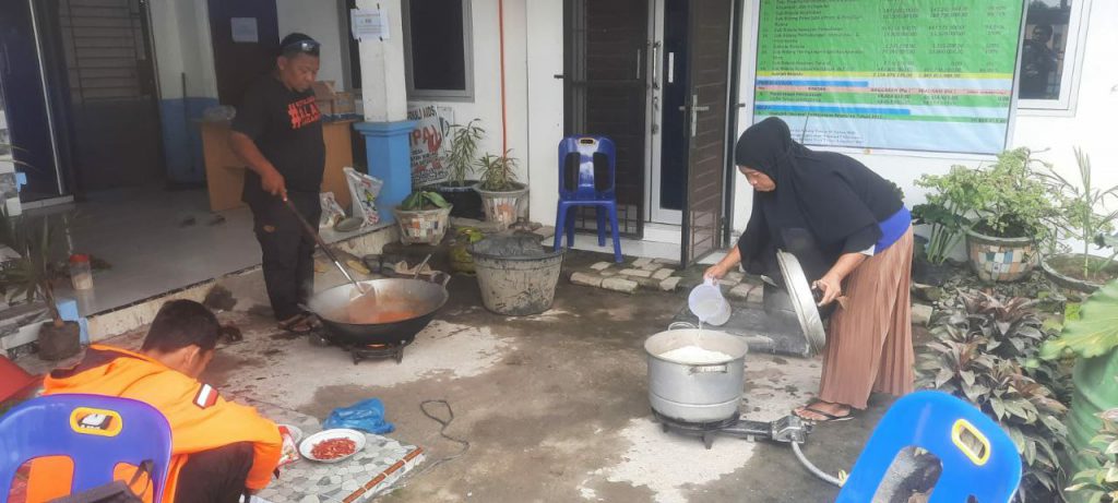 Photo submitted to PetaBencana – community organized open kitchens offer safe spaces for flood affected residents.