Author: Disaster Map Foundation (Yayasan Peta Bencana)

  • AI meets Gotong Royong: Over 25,000 Indonesians Trained in Nation-Wide Preparedness Campaign

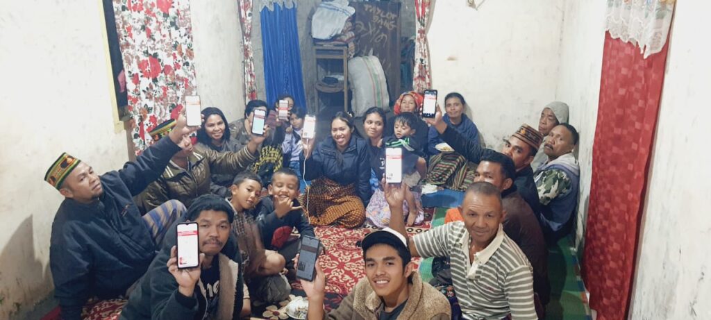
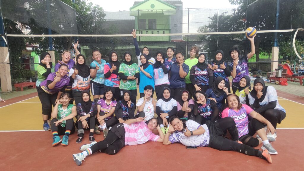
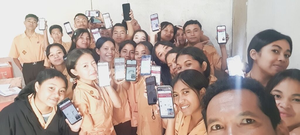
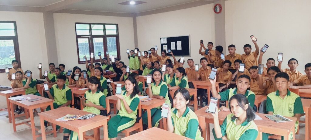
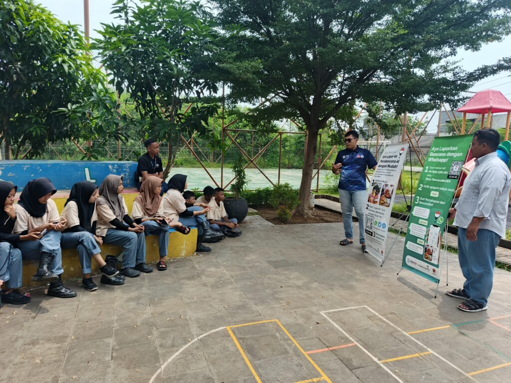
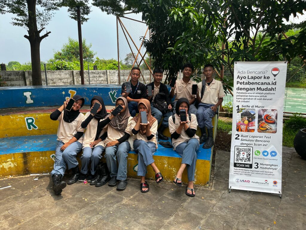
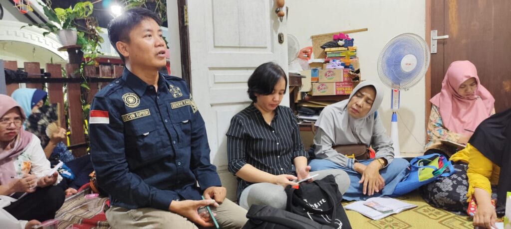
    As part of the official commemoration of Hari Kesiapsiagaan Bencana (HKB) 2025, over 25,000 participants across 22 provinces were using AI tools to train their communities in disaster preparedness as part of a campaign organized by Yayasan Peta Bencana. Carried out under the spirit of #BergotongRoyong, the campaign activated youth leaders, educators, and community trainers to engage thousands in workshops, simulations, and collaborative preparedness activities. 

    Participants simulated real-time disaster reporting with DisasterBot, an AI-assisted bot developed by Yayasan Peta Bencana in partnership with BNPB. DisasterBot is an online chatbot – now integrated into WhatsApp, Telegram, Twitter, and Facebook – that reaches out to residents in disaster affected areas and helps them to submit real-time disaster reports. These reports are mapped on a free and open source platform, PetaBencana.id, and used to assist government agencies and first responders in response and recovery. 

    “Technology alone doesn’t build resilience—people do,” said Nashin Mahtani, director of Yayasan Peta Bencana. “The true power lies in pairing the deep, place-based knowledge of communities with the amplifying capacities of technologies we have today to create a response system that is faster, more accurate, and more deeply rooted in the people it serves. When AI tools are designed carefully and collaboratively, with communities at the center, they can amplify local knowledge helping scale everyday acts of community coordination into a collective, life-saving force.”

    HKB, a national initiative launched by Badan Nasional Penanggulangan Bencana (BNPB), calls on all sectors of Indonesian society to strengthen their readiness in the face of disasters. This year’s observance comes at a critical moment: as Indonesia and the broader region grapple with intensifying climate-related hazards—from extreme rainfall and flooding to prolonged drought and sea-level rise—community-centered disaster preparedness is more urgent than ever. Between January 1 and April 2, 2025, Indonesia faced 804 natural disasters, based on data from the National Disaster Management Agency (BNPB). Floods topped the list as the most frequent disaster, with 547 reported cases.

    One of the participants of PetaBencana’s campaign, Mr. Kasbu, from BPBD Rokan Hilir Regency, said that in facing a disaster, we cannot stand alone: “Because disasters can happen at any time, preparedness must begin as early as possible.” He emphasized the importance of mobilizing the community, working together to build resilience. “It’s never too late to start preparing,” he said.

    “Mutual aid is not only carried out between communities, but can also be established with related government agencies. When communities reported flooding through the PetaBencana.id platform earlier this year, the report was immediately received and followed up with quick action by the local government. The government sent assistance in the form of heavy equipment to carry out dredging, in order to reduce the risk of flooding in the affected areas that had been reported by volunteers. Through the PetaBencana.id platform, residents also conveyed the various needs of affected residents directly from the field. This information allows the local government, BAZNAS, and the Social Service to distribute aid in a targeted manner. The spirit of true mutual cooperation is reflected in the involvement of all parties—both the community and the government—in building resilience together.”

    Jumriah, a volunteer for BAZNAS Disaster Response in South Sulawesi, shared the role that technologies like PetaBencana.id plays in enabling communities to collaboratively respond during disasters—gathering important information about damage, number of victims, resource needs, and progress in the recovery process. With the power of verified informatiom, Jumriah demonstrated how every resident can come together to build a stronger, more climate resilient future. As discussions about resilience deepen, the campaign is also laying the groundwork for what comes next.

    Building on more than a decade of community-driven disaster response work, Yayasan Peta Bencana is preparing to launch a new initiative: PetaGotongRoyong. The platform aims to expand the model of collective preparedness by supporting peer-to-peer coordination and mutual aid before, during, and after disasters.

    PetaGotongRoyong enables neighbors to quickly locate help, share resources, and organize responses through an open, accessible digital interface. The platform builds on lessons from past emergencies—where communities have often improvised local solutions while waiting for formal aid—and reflects the growing need for flexible, community-led infrastructures as climate extremes become the new normal.

    The official public launch of PetaGotongRoyong will take place on May 17, 2025, with a showcase of the technology and the stories of the communities helping to shape it.

    As the region faces urgent environmental challenges, initiatives like HKB—and the systems of care they activate—highlight a broader shift in disaster governance. Not just toward early warning, but toward early organizing. Not just resilience, but solidarity,

    And in Indonesia, where gotong royong is not a buzzword but a lived ethic, this movement is already underway.

  • 2025 Amid triple cyclone, community-led information sharing shapes disaster response

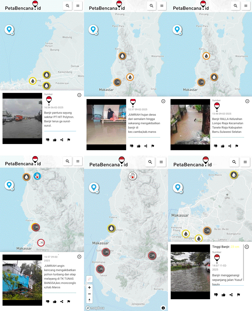
    Heavy rain and strong winds have caused flooding in several villages in South Sulawesi since Friday, February 7, 2025 (7/02/25). The popular tourist destination of Bali has also been severely affected, with disruptions to land, sea, and air travel. Floodwaters have inundated homes and public infrastructure, with some areas experiencing water levels reaching waist height. As floodwaters rose, PetaBencana.id, recorded a surge in community-generated reports, enabling emergency response teams to act swiftly in affected areas.

    Reports submitted to PetaBencana.id from residents in Turikale District, Lau District, Bontoa District, Mandai District, Moncongloe District detailed flood levels ranging from ankle to waist-high. Community-led information sharing via PetaBenacna.id played an important role in shaping evacuation efforts. Verified community reports provided essential information to emergency response teams and volunteers to immediately direct aid to locations that need it most.

    In response to reports posted on PetaBencana.id, BAZNAS teams quickly dispatched rubber boats to evacuate residents in flooded areas of Tanralili District, Borong Village, and Ammarrang Hamlet, Maros Regency.

    Jumriah, a resident from South Sulawesi, underscored the role of community participation in shaping disaster response:

    “As heavy rains and extreme wind continue to affect our area, PetaBencana.id allows us to support each other and strengthen community preparedness by providing a simple way to view and share disaster reports in real-time. Witnessing the quick response that has emerged from reports shared on the platform, I am increasingly aware that disaster mitigation is our shared duty and responsibility.”

    As heavy rains continued, PetaBencana.id also received an increase in reports documenting the impacts of extreme wind, with incidents of fallen trees blocking roads and rooftops being blown off in Simbang, Tanralili, Turikale, Lau, Moncongloe, and Camba Districts. PetaBencana.id’s real-time data enabled local authorities and volunteers to quickly identify and clear blocked roads, ensuring the safe movement of residents and emergency responders.

  • Yayasan Peta Bencana Announces New Name for Its Open-Source Software, Reinforcing its Unique Development

    TLDR; What happened to CogniCity? It grew up — got a passport, learned new languages, and thrived under the care of Disaster Map Foundation. So to reflect its development and maturity over the last 8 years, it’s getting a new name: Siti OSS.

    Disaster Map Foundation [Yayasan Peta Bencana] proudly introduces Situational Intelligence Open Source Software (Siti OSS) as the new identity of our open source software that has been in continuous development since 2017. This renaming highlights the evolution of the software into an advanced, specialized, and uniquely equipped system that goes far beyond its origins to address today’s most urgent challenges.

    Initially developed through academic research at the Smart Infrastructure Facility at the University of Wollongong (2013-2016) and MIT Urban Risk Lab (2016-2017), the software —formerly known as CogniCity OSS— has undergone radical transformation since MIT formally transferred the software and code to Disaster Map Foundation in 2017. In 2019, a pivotal development partnership with CivicDataLab further propelled the evolution of the software.

    Together, Disaster Map Foundation and CivicDataLab have completely re-engineered the code into an enterprise-level disaster response coordination system built to meet the needs of users and partners. Since 2017, Siti OSS has been shaped by the real-world needs of frontline communities and the expertise of teams embedded in disaster-prone regions. Through years of active engagement with first responders, local governments, and at-risk populations, the platform has been continuously refined to meet the complexities of on-the-ground disaster coordination. 

    Through iterative development, the code base has been re-engineered to include expanded hazard and geographic coverage, automated notification systems, logistics coordination tools, expanded feature sets, and refined parameters that enable localization across different geographies and scales. A complete system architecture overhaul ensures the platform can handle event-driven usage spikes while maintaining top-tier energy efficiency. This code powers the award-winning platforms PetaBencana.id in Indonesia, MapaKalamidad.ph in the Philippines, as well as pilot platforms AafatInfo.pk in Pakistan and Mapeatudesastre.com in Panama. With its expanded capabilities and renewed identity, Siti OSS continues to set new standards in disaster coordination and climate adaptation technology.

    Why the Name Change?

    As our software has grown and diverged from its initial foundation, we recognize the need for a name that reflects its current state and future direction. Over 95% of the code has been completely reengineered, making Siti OSS fundamentally distinct in both structure and functionality, with only minimal elements of the original code (CogniCity OSS) remaining. This update ensures clarity for our users, collaborators, and the broader open-source community, preventing any confusion between our work and the legacy codebase from which it was forked.

    Contributors

    Since 2017, the development of Siti OSS has been led and stewarded by Disaster Map Foundation [Yayasan Peta Bencana], under the leadership of Nashin Mahtani and, since 2019, in partnership with Deepthi Chand and CivicDataLab. The software’s evolution into its current form is the direct result of these collaborations and the sustained efforts of teams embedded in disaster-prone regions.

    All contributors are publicly and transparently recognized on our GitHub repository. This ensures a clear and accessible record of the community of developers and partners who continue to shape Siti OSS.

    What’s Next for Siti OSS?

    With this rebranding, we reaffirm our commitment to the continued development of Siti OSS as a powerful tool for situational intelligence and community-led information sharing. We invite the global open-source community to join us in shaping its future.

    Siti OSS is evolving to cover broader aspects of crowd intelligence including crowd logistics, volunteer coordination, accessibility, scalability to multiple geographic locations. Siti OSS is also generalizing for domains outside disasters, applicable to a range of issues that would benefit from crowd intelligence. To explore the latest developments or contribute to the project, visit our GitHub repository: https://github.com/petabencana.

  • 2024: A year of collective action

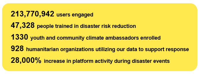
    As 2024 — the hottest year on record — draws to a close, we are reminded that the story of this year is not just one of crisis, but of resistance, care, and possibility. It has been a year of escalating climate impacts, with record-breaking heat and a relentless cascade of disasters worldwide. Yet, in these moments of crisis, we also witness extraordinary ingenuity and solidarity as communities step forward to care for one another. PetaBencana.id and MapaKalamidad.ph were built to support this collective power. By leveraging what communities already know and do best – looking out for one another – these platforms have transformed smartphones and social networks into life-saving infrastructures, shaping systems of care that rise to the challenges of our time.

    This year, that transformation took on new dimensions. This year alone:

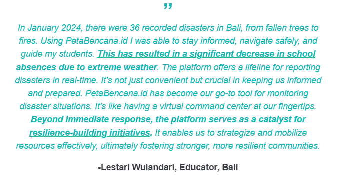
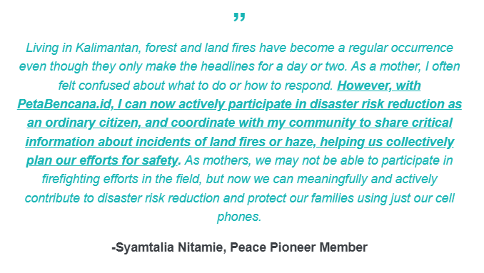
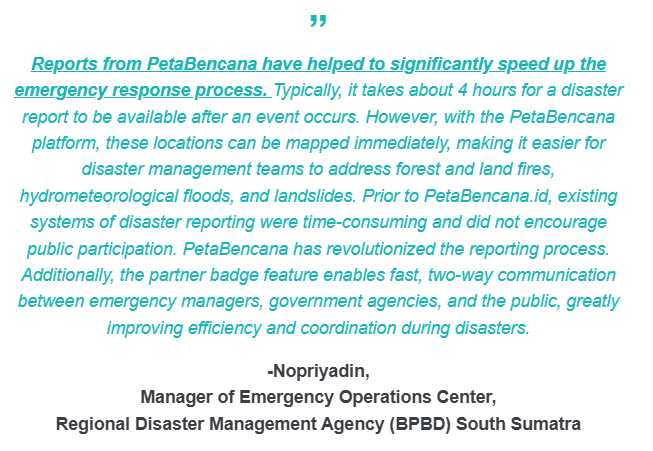
    In 2024, our platforms experienced a 150% increase in resident-submitted disaster reports compared to the previous year. Every disaster report submitted is a reminder that resilience is not a solitary act. It is a neighbor marking a flooded road, a parent warning others of a fire, a community leader sharing critical updates. It is the collective intelligence of millions, brought together in real time to protect what matters most. We have received heart-warming messages from mothers, teachers , youth, emergency managers, responders on what it has meant to collectively participate in disaster risk reduction efforts:

    🌀 During Super Typhoon Carina (Typhoon Gaemi) in the Philippines, MapaKalamidad.ph received over 300 typhoon reports within a 36-hour period, and became a key line of communication between communities, local government units, and the Office of Civil Defense (OCD) as resident-reports helped shape and guide first response. This year, over 900 humanitarian organizations have been using the data from PetaBencana.id and MapaKalamidad.ph to support response, exemplifying the power of collective intelligence in transforming systems of care. According to Kasbu, emergency manager at the Regional Disaster Management Agency (BPBD) of Rokan Hilir:

    🙋Our movement is sustained by the millions of people who share their knowledge, report disasters, support their neighbors, and contribute to building a future rooted in mutual care and collective resilience. A key catalyst for this movement is our network of youth and climate ambassadors, which this year grew to 1330 active ambassadors. We are proud and grateful to work with the next generation of leaders, who continue to demonstrate that even though youth are among the most affected by climate-related disasters, they are also leaders of change in their communities. Supported by our micro-grant programs, their proactive initiatives have collectively trained over 42,174 people in disaster preparedness this year alone. That’s a 350% increase in community-led initiatives compared to last year! 🤩 

    ⭐We’ve marked some significant milestones this year:

    At the start of the year, MapaKalamidad.ph expanded to a multi-hazard mapping platform for all of the Philippines. Less than a month after the launch, residents were already leveraging the newly integrated multi-hazard functionalities during the Earthquake in Caraga. Localizing our open-source software for the Philippines has been a deeply rewarding experience, showcasing how software can serve as vital knowledge infrastructure. By building on our work in Indonesia and sharing both technical tools, as well as strategies and lessons in community research, design, and outreach, we launched a multi-hazard platform in record time. It is a testament to the strength and importance of working on open source solutions for climate adaptation, as well as to the power of collaboration and knowledge exchange among the Global Majority.

    In July, we marked a major milestone for climate adaptation with the launch of the first free real-time disaster notification service for all Indonesians. 🚨 This initiative addresses a profound challenge highlighted by the IPCC Sixth Assessment Report: the lack of locally-relevant, timely information as a critical barrier to effective climate adaptation. In just five months, over 24,535 notifications have been sent, bridging vital information gaps to help residents stay informed and act quickly. But this service is more than just a technical milestone—it is rooted in an understanding of how people perceive and respond to risk. By designing notifications informed by extensive research across diverse demographics, and integrating local knowledge, we ensure that these notifications translate into meaningful action.🙌 The stories that our communities have shared have reaffirmed that beyond technical platforms, PetaBencana.id and MapaKalamidad.ph are spaces for connection and agency. The collective spirit of gotong-royong in Indonesia and bayanihan in the Philippines, that have been renewed through these challenging times is a testament to the strength of community-led climate adaptation.

  • PetaBencana.id officially partners with Indonesian Fishermen’s Union (KNTI) to strengthen coastal and ocean resilience  for traditional fisher communities

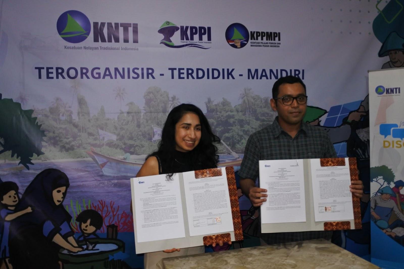
    Director of Yayasan Peta Bencana, Nashin Mahtani, and KNTI General Chair, Dani Setiawan, sign a Memorandum of Understanding on November 25th, 2024 to formalize the partnership among the two organizations.

    We are thrilled to announce our official partnership with the Indonesian Traditional Fishermen’s Union (KNTI) to strengthen coastal and ocean resilience!

    According to KNTI General Chair, Dani Setiawan, “Tidal floods are a scourge for coastal communities, especially for coastal women. The presence of tidal floods adds to the burden of coastal women, because in addition to submerging houses and roads, tidal floods also often hinder coastal women from producing processed marine and fishery products. This collobaration with Yayasan Peta Bencana will support KNTI’s members – who are small and traditional fishermen, cultivators, traditional fish farmers, processors and marketers of marine and fishery products – in adapting to climate change.”

    At Yayasan Peta Bencana, our mission is to make life-saving disaster information accessible to all. Partnering with KNTI allows us to extend the reach of our platform, PetaBencana.id, to Indonesia’s traditional fishermen, ensuring that those most at risk can make informed decisions during disasters and adapt to a changing climate.

    This collaboration is a vital step in addressing the unique challenges faced by Indonesia’s fisher communities, who rely heavily on the ocean for their survival but increasingly face existential threats from environmental degradation and climate change. By leveraging open-source technology and community organizing, Yayasan Peta Bencana and KNTI aim to strengthen disaster preparedness, protect coastal livelihoods, and strengthen safety to oceanic hazards as a result of climate change.

  • 2024 A new milestone for climate adaptation: PetaBencana launches first real-time disaster notification service for Indonesia

    In July, Indonesia has been simultaneously affected by massive flooding and forest fires; with flooding in Gorontalo affecting more than 36,000 residents, landslides as a result of heavy rain in Central Papua affecting 3,265 people, and forest fires in Aceh, Sumatra Selatan, and Jawa Timur. According to the National Disaster Management Agency (BNPB), Indonesia experienced a 39.39% rise in natural disasters in 2023, with a total of 5,940 events compared to 3,544 the previous year. According to Head of BNPB, Suharyanto, Indonesia now experiences 15-17 disasters every day. 

    Climate-related disasters have become increasingly frequent and severe, posing significant challenges across the country. While extreme weather events cannot always be prevented, immediate alerts can significantly reduce the impact of disasters by allowing residents and response teams to take swift preventive measures. During a disaster, access to the most up-to-date information is critical for communities to understand what actions can be taken to protect themselves, their families, and their properties. 

    The United Nations Office for Disaster Risk Reduction (UNDRR) has highlighted that telecommunications are the future of disaster warning systems. The growing availability and reach of mobile networks and services in particular, make it possible to reach communities at risk and provide people with actionable information. Indonesia is particularly suited to adopt mobile networks for disaster warning systems, with over 80% of the population utilizing internet-connected smartphones, and mobile connections equivalent to over 128% of the total population. 

    Today in Indonesia, the latest advancements in geospatial technology and AI, combined with the strength of local knowledge, are now being leveraged to deliver real-time notifications and information about ongoing disasters. On July 29th, 2024, Yayasan Peta Bencana, with support from the United States Agency for International Development (USAID), publicly launched the first real-time disaster notification service for all residents across Indonesia. The disaster notification service, freely available to all residents through common messaging platforms such as WhatsApp, provides immediate notifications about earthquakes, floods, volcanic eruptions, forest fires, haze, and extreme wind, including the most up-to-date information about impacts of these disasters as they change in real-time. The notifications are customized based on geographic location, ensuring relevant, localized information for every resident. As the first free, real-time disaster notification service in the world, the innovation demonstrates the leadership of Indonesia in advancing tech for climate adaptation. 

    Decision support tools for climate adaptation have tended to concentrate information in control rooms, where dashboards are only accessed by small groups of professionals. However, to meet the challenges of the climate emergency, every single resident must be empowered to participate in community-led adaptation efforts. By leveraging the network of mobile phones that we all carry in our pockets, we can ensure that every resident is informed and prepared to adapt to increasingly erratic weather patterns. This service represents a major milestone for disaster risk reduction in Indonesia.

    Head of the Meteorology, Climatology, and Geophysics Agency (BMKG), also the Permanent Representative of Indonesia to the World Meteorological Organization – Dwikorita Karnawati, has emphasized that disaster warning systems must be embedded and communicated in ways that are easy to understand, and relevant to the needs of local communities. According to Dwikorita Karnawati, the success of disaster warning systems can be measured by a reduction in the “gap” between information and the community’s ability to act quickly and appropriately. According to Dwikorita Karnawati,

    “The combination of modernization of tools and technology and local wisdom can be an effective step to minimize the impact of disasters that occur in Indonesia.”

    Yayasan Peta Bencana’s disaster notification service integrates data from multiple sources, including local resident observations, leveraging the tacit knowledge of communities, in order to ensure the accuracy, immediacy, and relevance of disaster notifications. As extreme weather events increase in frequency and intensity, the need for improved synergy, communication, and coordination between multiple stakeholders is more critical than ever. As Dwikorita Karnawati highlights, warning systems must contain actionable information in order to be effective. To this end, BMKG and Yayasan Peta Bencana have embarked on an exemplary partnership, with each organization’s disaster information systems feeding into eachother, synergizing local wisdom with the latest advancements in technology to improve warning services. 

    As BMKG warns eastern parts of Indonesia to anticipate heavy rain and potential flooding in the coming months, and western parts of Indonesia to anticipate forest fires in the peak of the dry season, it is more timely than ever to have a service that enables all Indonesians to stay informed on the most up-to-date situations to stay safe. 

  • Expanding South-South Solidarity: Adapting Real-Time Disaster Mapping for Colombia

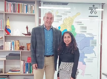
    On March 5, 2024, Director of the Disaster Map Foundation, Nashin Mahtani, met with the Director General of SENA, Jorge Eduardo Londoño Ulloa, former Senator of Colombia, at the SENA office to discuss a groundbreaking collaboration in disaster resilience. This meeting marks an important step in South-South knowledge exchange and solidarity, as we work to share and adapt PetaBencana’s real-time disaster mapping platform for use in Colombia.

  • 2023 2023 in review

    At a glance, here is what we achieved together this year: 

    533 organizations using the data from our platforms;

    853 Youth & Climate Ambassadors enrolled;

    24,402 Individuals Trained;

    26,000% increase in platform activity during disaster events;

    171,972,349 users engaged

    The start of the year marked a significant milestone for Yayasan Peta Bencana, with the launch of WhatsApp’s First Humanitarian Chatbot! Given that 83% of Indonesia’s 171 million internet users use WhatsApp, the launch of DisasterBot on Indonesia’s most used application represents a significant milestone for scaling community engagement in disaster risk reduction and recovery efforts.   In 2023, with over 2200 recorded disaster events in Indonesia, community-led information sharing through PetaBencana.id and MapaKalamidad.ph continued to shape disaster response as millions of users accessed the platforms to coordinate for safety and response. During the eruption of Mount Merapi in March 2023, resident reports detailing the amplitude, direction, distance, and duration of pyroclastic flow helped communities in surrounding areas to navigate safely. During the June 2023 earthquake in Yogyakarta, residents informed each other about inaccessible roads and damaged buildings to avoid dangerous areas, while first responders shared updates about rescue, recovery, and rebuilding efforts.  

    This year, we noticed that residents were increasingly using PetaBencana.id to coordinate resource distribution, for example in setting up community kitchens. Beyond a tool for disaster information sharing, PetaBencana.id and MapaKalamidad.ph have become tools for peer-to-peer coordination at a massive scale. We continue to see that in the immediate aftermath of disasters, neighbors are always the first to help each other. By making risk information accessible, open, and actionable, PetaBencana.id and MapaKalamidad.ph address information gaps, reduce disparities, and ensure that all residents have the opportunity to protect themselves and their communities during disasters. Placing the power of data in the hands of communities encourages a collective and proactive approach to disaster risk reduction and climate adaptation. To further support these forms of mutual aid, we are now spearheading the next major phase of our software development; a “crowd logistics” feature dedicated to supporting resource and logistic coordination at a community level. Stay tuned for its release in the new year!  

    PetaBencana.id and MapaKalamidad.ph have continued to support several organizations for emergency planning and response, helping first responders and government agencies to respond more quickly and effectively, including at the national emergency management agencies – BNPB and the Office of Civil Defense. Tracking humanitarian needs by way of resident reports made via social media and through our Humanitarian Chatbot system enables disaster managers and government agencies to see, share, and respond to these reports with unprecedented resolution and speed.  According to Theophilus Yanuarto, Public Relations Officer atIndonesia’s National Emergency Management Agency (BNPB):

    “PetaBencana.id provides critical information for the public to support community-level response and increase public awareness about disaster risks, response, and recovery. The crowdsourced data on PetaBencana.id helps emergency managers at BNPB effectively respond to disasters. It is critical to have increased public participation in disaster information sharing to reduce risk for the nation as a whole.” 

    In a time of increasing extreme weather events, information sharing through open data and open APIs is more vital than ever to enable coordinated decision making across all agencies and networks. In Indonesia, the Meteorological Agency (BMKG), continued to utilize our open data streams and leverage the real-time disaster reports submitted to PetaBencana.id to improve and validate the agency’s Impact Based Forecasting. The crowd-sourced information collected by PetaBencana.id serves as a “ground-truth” for BMKG’s prediction models, providing the granularity and hyper-local information to complement and enrich the agency’s overview of weather patterns. 

    In the Philippines, we have been working with disaster affected communities, scientists, journalists, emergency managers, first responders, academics, aid agencies, and a wide range of experts to collectively extend the MapaKalamidad.ph platform from a real-time flood map to a real-time multi-hazard map. Co-design and integrating local knowledge into DRR tools continue to underly all our work; we are inspired by the enthusiasm of residents in the Philippines to build adaption tools together, for each other.

    We are excited to announce that in January of the new year, MapaKalamidad.ph will be launched as a multi-hazard disaster mapping platform for all of the Philippines! Stay tuned for more updates!  

    We continued to grow enrollment into our youth and community climate ambassador programs, with now 853 active ambassadors. We are proud and grateful to work with the next generation of leaders, who continue to demonstrate that even though youth are among the most affected by climate-related disasters, they are also leaders of change in their communities. Through the support of our micro-grant programs and their proactive initiatives, our youth and community ambassadors have collectively trained over 12,615 people in disaster preparedness this year alone.  From initiating activities ranging from post-disaster psychological risk reduction, to beach cleanups, to first aid trainings, to mobilizing local government commitment to youth preparedness, we are moved at the ways by which young leaders are building stronger communities through contextually embedded actions that stem from lived experience and concerns. 

    According to youth ambassador Arindra Unigraha, “PetaBencana.id has a significant impact on the younger generation in Indonesia, especially in increasing youth agency, engagement and awareness about disaster risk reduction. This is knowledge and support that we typically do not receive at school or at a municipal level – but the gap is now filled by Yayasan Peta Bencana.”  


    Beyond South East Asia, this year our open source software was extended to support communities in South Asia and Latin America. With UNDP, we ran a successful pilot in Panama, where the real-time reporting platform received several critical reports in just the first week of its release.   We are also excited to announce our partnership with re:arc institute for our “SouthxSouthEast Asia” initiative, towards the development of a real-time flood mapping platform for Pakistan. In the aftermath of the devastating floods in 2022 which affected 33 million residents, our teams from Indonesia and the Philippines are collaborating to support the deployment of community-based decision support tools for Pakistan; this is a testament to the strength of open-source software in fostering lateral exchange amongst the Global Majority, advancing more democratic forms of climate adaptation. The collective spirit of gotong-royong in Indonesia, bayanihan in the Philippines, and mutual aid globally, that have been renewed through these challenging times is a testament to the strength of community-led climate adaptation.  We thank you for your role in building this impressive community, and we look forward to continue working together to #ReduceRiskTogether in the region, and beyond

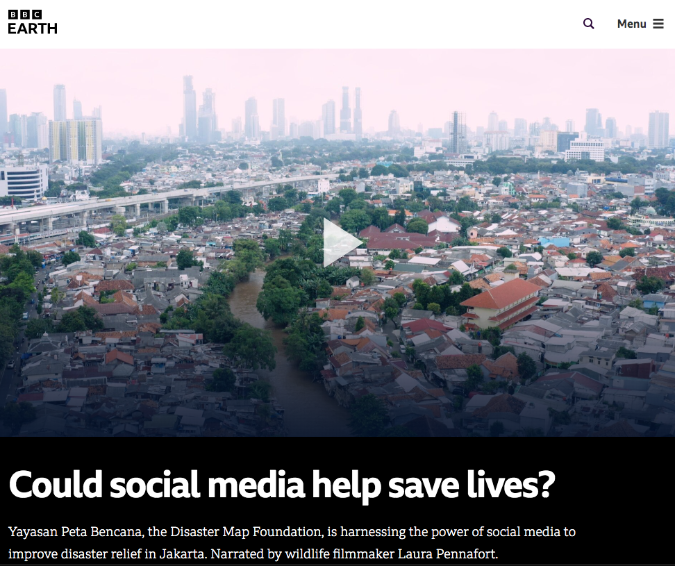
  • 2023 BBC Earth Publishes Short Film about PetaBencana.id

    “Can we harness the same gotong-royong in the face of our planet’s changing climate?”

    – Laura Pennafort, Wildlife Filmmaker

    Building on the momentum of the series, Frozen Planet II, BBC’s digital impact campaign, Our Frozen Planet, highlighted PetaBencana’s work as an exemplary model of community-led climate adaption. We are excited to see how the film spotlights the Indonesian spirit of gotong-royong that PetaBencana is inherently founded on!

    Watch the full video here

  • 2023 PetaBencana.id’s software adapted to power a Flood Mapping Platform in Panama

    Our humanitarian chatbots now speak Spanish! In collaboration with UNDP, Yayasan Peta Bencana launched a pilot flood-mapping platform for Panama. In just its first week of release, the platform received several reports during flooding in the city as residents used the platform to share real-time updates and coordinate response.