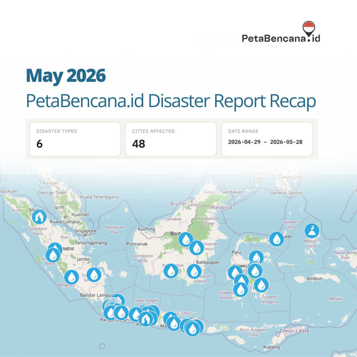
Across hundreds of resident reports submitted to the real-time disaster map, PetaBencana,id during May 2026, floods were not only associated with heavy rainfall itself, but with failing infrastructures, drainage systems reaching capacity, tidal flooding creeping further inland, and water lingering long after storms had passed. In addition, several reports in May described flooding that arrived on top of conditions already in distress, or that triggered secondary disasters more destructive than the accumulation of water.
This points to several important shifts in how disasters are unfolding.
- Flooding is becoming increasingly difficult to predict because the hazard is no longer limited to rainfall alone. Water now moves through landscapes already shaped by accumulated vulnerabilities: overloaded drainage systems, unstable riverbanks, saturated soil, land subsidence, erosion, and infrastructure under constant pressure.
- In many cases the accumulation of water is not the primary disaster, but the trigger or context for structural failure. Several reports described landslides, road collapses, or bank erosion as the primary event: a landslide along the Kali Ciliwung in Depok (May 27); a landslide in Kampung Ardio, Kota Bogor (May 2); a cliff collapse onto a road in Ciamis (April 28); road erosion cutting off two villages in Lebong, Bengkulu (May 8). These sudden failures are often the most destructive because they emerge from conditions that are difficult to model precisely and unfold rapidly in dense and interconnected environments. This is why real-time information becomes increasingly important for save navigation and response.
- Communities are reporting conditions that persist, recur, or compound; disasters unfolding on top of previous disasters. Several regions appeared repeatedly in the reports, particularly areas along the north coast of Java. Accumulated risk places increasing and constant stress on infrastructure, increasing the likelihoods of ‘sudden’ failures, or failures unanticipated in prediction models. Jl. Raya Sapan in Kabupaten Bandung flooded on May 21 and again on May 26, two separate reports from the same street within five days. Kutai Barat and Mahakam Ulu both reported river overflow from the Sungai Mahakam system within a day of each other on May 18 and 19. In Cianjur, a banjir bandang (flash flood) struck Desa Jamali on the night of April 30, with a report filed on May 1 noting that water had still not receded by the following day, with depths reaching 50 centimeters in residential areas. In Demak between May 13-26, the water rose to above 1 meter, fell to 36 cm, and rose again above 1 meter. For many communities, flooding is experienced as prolonged instability.
As climate patterns become less predictable, adaptation will depend not only on forecasting hazards, but on understanding how risk accumulates across neighborhoods, river systems, and everyday infrastructure. What communities are documenting through PetaBencana can function as a kind of early trigger system; not only for emergency response, but for identifying deeper shifts in environmental and infrastructural stress before they fully emerge as large-scale disasters.
Leave a Reply